  
|
Posted By Hannah Sherrard,
07 December 2023
Updated: 09 January 2024
|
Orienteering Techniques Explained
This next article from our Outdoor Adventure Navigation Group series sees Chris Sweetman FRIN provide a breakdown of five orienteering techniques. This article was first published in the Nov/Dec edition of Navigation News.
Chris is a qualified teacher and mountain leader who taught land navigation and expedition skills in a further education setting for over 25 years. Formally a British Orienteering Instructor and Club Coach, Chris is currently a walks leader for the Ramblers’ Association and the Long Distance Walkers Association. He is also a committee member of RIN’s Outdoor Adventure Navigation Group.
In my previous article: ‘What did orienteering ever do for land navigation?’ (Navigation News July/August 2023) I listed the following techniques along with a brief description:
☛ Attack points
☛ Aiming off
☛ Handrail features
☛ Collecting features
☛ Catching features
The objective for this article is to investigate and provide details of these five techniques which were developed by the sport of orienteering. All of these techniques have been in use by British Orienteering (BO) from at least the mid1970’s. Since this period these techniques have gradually gained acceptance in land-based navigation, where the participant has to navigate ‘off-piste’. Consequently, they are now embedded in UK mountain training schemes, included in the National Navigation Award Scheme (NNAS) and even feature in relevant units in some education qualifications. However, they are still virtually unknown in land-based navigation activities where the main route choice is using linear features. Alongside these five techniques, the orienteer will need a thorough navigator’s insight which will include the ability to work out distances, use compass bearings and interpret contours. Please note that the diagrams used here to illustrate the techniques are stylised and simplified to show an outline of each technique. There will be a mix of signs and symbols utilised, and they are not necessarily those used by the Ordnance Survey (OS), Harvey Maps or meet the standards of the International Orienteering Federation mapping specifications.

Orienteering Techniques in Orienteering British Orienteering currently use the Step System for coaching. This links to colour coded courses and the range of techniques required for each ability level. In the following passages each stage in the Step System will just include reference to the five techniques that are the focus of this article. The Step System starts at Level 1/White course and then gradually moves to advanced Level 5/Green/Blue/ Brown courses. At the start of competitive orienteering Level 1/White participants will orienteer along paths and tracks, so will need to understand how to use handrail features. At Level 2/Yellow they move on to understand and develop the catching features technique so they can leave a line feature. For Level 3/Orange/Red they develop aiming off at the base stage so they can cut corners, and advancing toward the top of Level 3 they will need to be able to use attack points to simplify legs. The base stage of Level 4/ Light Green includes collecting features to enable them to navigate over long legs. Finally, for Level 5 the participant will have the ability to use all these techniques, enabling them to compete in the top level colour coded courses: Green, Blue and Brown. With technical difficulty being similar, the differentiation between these top level colour coded courses is the stated distance and the greater variety in length between control points, including longer legs which will also test levels of concentration.
Orienteering Techniques in Mountain Navigation
These five techniques are also part of mountain training and come under the umbrella of micro-navigation techniques. The first mountain leader training guide: Mountain Leadership (1976) mentions aim-off (1976:8). That is all there was - just a mention, and no illustrations. In the second edition: Mountaincraft and Leadership (1984) the navigation section became more expansive and the following techniques were included, now with a description of the technique supported by illustrations. Two techniques: aiming off and attack points were named exactly as per terms used in orienteering. However, the author used the term tick-off features which are essentially identical to collecting features and guide-line features, which are also identical to handrail features. British Mountaineering Council/Montane: Hiking Essentials Navigation Resources published in 2022 include handrail and catching features. The latter is described as: “An obvious feature the (sic) informs us we are at a required or particular point.” This sounds more like the orienteering term collecting features....
Check out the RIN Outdoor Adventure Navigation Group webpage to learn more about the group.

Tags:
Hiking
Mountain Navigation
Orienteering Techniques
Outdoor Adventure Navigation Group
Outdoor Navigation
Rambling
Walking
Permalink
| Comments (0)
|
|
|
Posted By Andy Proctor and Guy Buesnel,
06 November 2023
|
UK Government’s 10 Point Resilient PNT framework is welcome news for the RIN PNT Advisory Group
By Guy Buesnel and Andy Proctor
UK Government announces a Resilient PNT Framework
The UK government has announced its long awaited Resilient PNT framework including a crisis plan, to support UK Critical National Infrastructure and essential services, which have all been identified as being critically dependent on the use of PNT data from GNSS.
The plan includes the following points:
• Establishing a National PNT Office in the Department of Science, Innovation and Technology (DSIT) with responsibility for PNT policy, coordination, and delivery
• Retain and update the Cross Government PNT Crisis Plan
• Develop a proposal for a National Timing Centre
• Develop a proposal for ‘Ministry of Defence Time’
• Develop a proposal for a resilient, terrestrial, and sovereign eLORAN system to provide backup Position and Navigation
• Rollout resilient GNSS receiver chips, develop holdover clocks, and consider options for legislation on CNI sectors to require minimum resilient PNT
• Develop a proposal for a UK PPP Satellite-Based Augmentation System
• Explore options for Centres for Doctoral Training PNT and review PNT skills, education, and training
• Develop a PNT growth policy, including R&D programmes, standards and testing, to drive innovation for PNT based productivity
• Deploy existing R&D funding into a UK Quantum Navigator and investigate options for a UK sovereign regional satellite system
10-Point plan broadly welcomed by PNT community
The UK government believes that “strengthening PNT capabilities will give direction to the PNT industry, whilst fostering innovation, growth, and cutting-edge technology development, positioning the UK as a global PNT leader.”
This is welcome news for the UK academia and industry experts who have been raising awareness of the overdependence on GNSS in critical infrastructure and other application areas.
It also comes on the back of a updated London Economics study into the economic impact to the UK of a major disruption to GNSS, which noted that the impact of loss had risen from a conservative £1.1billion in 2017 to £1.4billion in 2021.
RIN PAG White paper addresses adoption of Resilient PNT
The announcement by the government was very timely, coming just a few weeks before the RIN holds its second “Leadership in PNT” event at the Royal Society and just after the publication of the updated UK National Risk Register, which included a risk of loss of PNT, and the publication of a RIN authored paper by the National Preparedness Commission noting the need to be more prepared for the loss of PNT services. In addition, the RIN PNT Advisory Group’s (PAG) published a white paper, “Recommendations to Promote the Adoption of Resilient Position, Navigation and Timing in the UK - With Growing Capabilities Come Growing Threats”
The white paper, the first major publication from the RIN PNT Advisory group asserts that Resilient PNT is an area in which the UK could provide leadership to improve PNT performance given the high level of expert knowledge and track record in innovation and excellence that the UK possesses.
The RIN PAG has been involved in activities to support decision makers, regulators, industry, academia, and all involved in developing the Resilient PNT framework for the UK. It is developing plans to carry its work forward during 2024 and beyond; setting out tasks to support the government and National PNT office in the delivery of its ten-point framework will be high on its agenda. As well as developing and publishing its recommendations on the adoption of Resilient PNT in the UK, the Advisory Group since its formation has looked at the role of Low Earth Orbit (LEO) satellites for delivering PNT services, is involved in work to assess the need for a dedicated UK PNT Innovation Institute and national test framework, and is assessing the impact of new PNT technologies such as Quantum and AI. The PAG also will continue working with the Ministry of Defence on the use of PNT in defence, and ways to improve, nurture and grow the UK skills base.
“Multi-faceted Endeavour”
John Pottle, Director of the Royal Institute of Navigation, commented that the very welcome announcement by the government recognised that achieving greater PNT resilience was a multi-faceted endeavour. The ownership provided by the National PNT Office would provide policy and delivery oversight, and co-ordination across all stakeholders.
As well as improving national preparedness, the PNT framework has potential to help further strengthen the UK’s thought leadership and innovation in robust and resilient PNT.
Andy Proctor, Chair of the RIN PNT Advisory Group also welcomed the government’s announcement of the ten- point plan for a resilient PNT framework for the UK and said
“The announcement of the measures and recommendations set out in the framework are a welcome step forward in addressing the vulnerabilities due to the UK’s dependency on satellite-based PNT, particularly GNSS. GNSS supports around £320 billion (15%)* of UK GDP, improving the UK’s PNT robustness, security and resilience will be key to mitigating vulnerabilities to the loss of satellite-based PNT, and to capture the significant growth opportunities that the framework could enable.”
Challenges ahead
Recent world events are reinforcing the need for improved PNT robustness, security, and resilience across critical applications and national infrastructure – but the road ahead to implement the framework will not be without bumps – the UK is rapidly approaching its next General Election and whilst the National PNT Office will be working very hard to develop more detailed costed plans for the framework, there are bound to be some uncertainties and delays in moving the plans forward. The RIN has a strong role to play in providing government with a source of knowledge, expertise, and support that it can rely on whilst it tackles more challenging task of making the framework a reality.
As a learned society, the RIN brings a well-balanced voice to the task of raising awareness of PNT security and the need for responsible use of PNT more generally across society.
If you are interested in becoming a contributor to the RIN PAG work being planned for 2024, please contact either Andy Proctor (PAG Chair), Guy Buesnel (PAG Secretary) or Clare Stead (RIN Communications and Events Manager ) in the first instance.
* According to the 2022 UKSA Size and Health of the UK Space Industry Study
Tags:
pnt
resilient pnt
RIN PNT Advisory Group
Permalink
| Comments (0)
|
|
|
Posted By John Hasselgren,
02 November 2023
|
The twelve members visiting the PLA had travelled to the Gravesend headquarters, some by train but at least three by the pedestrian water ferry from Tilbury. They were greeted by Deputy Harbourmaster David Alsopp, who informed us of some of the conditions under which the PLA was able to assist and exercise some control over river users.
The Port has no shareholders and any surplus is reinvested in services. As a result, there is no Government funding required.
To conduct any activity on the river, a license from the PLA is mandatory. This includes obtaining consent for building or installing equipment on or over the tideway, even if it's just replacing handrails on piers, jetties, and riverside walks. The river traffic around the site of these works is also controlled. Even occasional events such as the New Year fireworks, the Boat Race, and the Great River Race require consent, as well as anything that requires sections of the river to be closed. It is surprising to note that there is no charge for assessing events and granting consent.
As part of their responsibilities, VTS Officers are tasked with conducting risk assessments and ensuring safety on the river. They achieve this by providing guidance to vessels that are entering or moving within the port. While the River Police are not as visible due to their lower numbers, they are available whenever there is suspicion of intoxication. They have access to breathalyzers on their boats and other equipment on shore to assist them when needed.
At this stage, David Alsopp had to leave us with members of his staff to attend another meeting.
PLA Hydrographic Services has a legal obligation to ensure navigation safety through their surveys and chart production. They also have a conservancy function, performing data analysis and mapping, and can undertake commercial survey work. The Services operate three vessels - Maplin, Thame, and Galloper - each equipped with survey equipment, along with remote and autonomous platforms, including three drones. The latter are operated by highly qualified pilots who must adhere to flight rules over London. Following our questions, we learned that remotely operated vessels are more likely to be used initially instead of autonomous ones. Remote surveys are a useful tool, but they are not yet utilized for main surveys. Instead, they eliminate the need to send large survey vessels into shallow waters and prevent people from being sent into dangerous areas. The survey data is transmitted in real-time using Starlink, which is capable of transmitting large files to the website. S-102 bathymetric charting enables the storage of high-resolution survey data, which is used to create paper charts available as .pdf files on the PLA website, and also as ENCs for the pilots working on the river. This results in a more efficient port operation.
To determine how often an area is surveyed, the Port of London Authority compares historic and current survey records, which reveal the regular movement of sandbanks within the estuary. The PLA has a Memorandum of Understanding with the UK Hydrographic Office (UKHO) and shares all survey data with them. The PLA also provides survey data to companies producing leisure charts. The carriage of paper charts is currently a requirement for vessels within the harbour, but the Hydrographic Department will phase them out following the UKHO.

Harbourmaster (SMS & VTS) Simon Phillips took over with many details of the port and its operation. All the berths for ships are privately owned, rather like the M25 with its service areas. VTS – Vessel Traffic Services – main concern is safety of life. The PLA’s VTS covers the largest area of any UK port being 600 square miles and 60 miles long, covering three sectors from two management centres. The lower part of the river and estuary is managed from Gravesend, where we were, and the upper part from a control room at the Thames Barrier at Margaretness. Both these control rooms are designed to be inter-operational, either being able to take over from the other in case of a serious failure such as a fire or terrorist attack.
VTS aims to provide essential and timely traffic information to shipping to assist in making on-board decisions. The traffic is organized to prevent the development of dangerous situations, with large ships becoming too close to one another. Navigation assistance is also given to aid on-board decisions. The VTS Supervisors are actually pilots who take turns in the control room and are informed of the location of vessels in the river and estuary by 17 radar scanners, 6 AIS base stations, 9 CCTV cameras, and 16 VHF radio stations. As I was once told, if the radar, the AIS, and a video camera all put a ship in the same location, they can be sure that is where it is! I had a question about the location of three of the radar scanners, which are out in the estuary and turn out to be sited on windfarms.
Afterward, we briefly visited the VTS control room where two VTS officers were on duty. Unfortunately, due to the current suspicious climate, we were restricted to the rear section and couldn't observe their work. While we were questioning Simon Philips, Ivana Carrioni-Burnett, chair of RIN's Marine Navigation Group and a Thames pilot stationed at Gravesend, joined us.
We were told that Thames pilots are evaluated based on their ability to bring in vessels of four different sizes. Regardless of their previous qualifications from other ports, all pilots begin with the smallest ships. As pilots gain more experience, they undergo assessments that determine whether they can move up to larger vessels. Furthermore, the largest ships that enter the port must have two pilots on board.

One of the most demanding jobs, it seems, run from a desk at the rear of the control room, is the logistics of arranging for pilots to meet up with the ship they are to bring into the port. This will frequently necessitate booking a taxi to get the pilot from Gravesend to where the pilot cutter will pick them up, usually Ramsgate, to ensure there is a cutter available and that they get to the ship in time. All this needs to take into account road traffic conditions and the state of the weather and tidal conditions.
The Small Craft Group thanks the PLA and staff for facilitating the visit. Half of the group then had lunch at a nearby pub.
John Hasselgren
18/10/2023
Tags:
PLA
Port of London Authority
SCG
Small Craft Group
Permalink
| Comments (0)
|
|
|
Posted By John Pottle,
01 November 2023
|
A report on the 2023 European Navigation Conference and plans for ENC2024
By John Pottle, RIN Director
First published in Navigation News Sept/Oct 2023 edition
In this article I shall aim to provide
a flavour of the very successful
2023 European Navigation
Conference (ENC), share how
the ENC is evolving (spoiler
alert = quite a lot!) and, with
that, how the RIN sees the
ENC series going forwards
as part of delivering its own
objectives and impact.

The 2023 European Navigation Conference attracted over
300 participants and was, literally, a sell-out success. Why
was this? Part of the success was the location – ENC2023
was held in the European Space Agency’s ESTEC facility
(European Space Research and Technology Centre). Many
positioning and timing-related businesses in Europe will have
active links to ESA and ESTEC, be they as customer, supplier
or collaborator.
Part of the success was accessibility, in that ESTEC is easy to
access and it’s convenient (though generally blustery!) to stay
in the one of the adjacent coastal towns. Thirdly, ENC2023
was run by a professional conference organiser (PCO) which
helped to shape a positive delegate experience overall.
The ENC series is owned by the European Group of
Institutes of Navigation (EUGIN). The RIN has always been
active and a supporter of EUGIN.
Professor Terry Moore is the current chair, with Bart Banning,
President of the Netherlands Institute of Navigation (NIN)
serving as vice-chair. The NIN led the organisation of
ENC2023, whose overall theme was resilient navigation (see
www.enc2023.eu).
Please join RIN and EUGIN - ENC2024
21-24 May 2024, ESTEC, Netherlands
www.enc-series.org
https://enc-series.org/2024 for more information
Tags:
ENC
European Navigation Conference
RIN events
Permalink
| Comments (0)
|
|
|
Posted By Hannah Sherrard,
05 October 2023
|
On Oct 2nd 2023 the Government announced it's new 30-point plan to "put drivers back in the driving seat". Read the Department for Transport article here. In the article below, previous RIN president, James Taylor, shares his own thoughts about how charges imposed on road users in the UK are utilised regarding the improvement of infrastructure and safety.
The Cost of Navigating Our Roads
James Taylor, RIN Past President, shares his concerns about how charges imposed on road users in the UK are utilised regarding the improvement of infrastructure and safety.
This article was first published in the March-April 2023 edition of Navigation News. View the full archive here.
The Royal Institute of Navigation, as a professional body and as a learned society, concentrates on Positioning, Navigation and Timing, and on Resilience. It does so in air, space, at sea and on land. In each of those sectors, the provision of supporting infrastructure, of resilience and accuracy, of effectiveness and efficiency, costs money. And where costs are involved, added value taxes and surcharges can be deployed by the provider, or by local or central Government, to change or to fine-tune behaviour, or to raise revenue. These remain the long-standing bases of any form of taxation.
In air transport, operating companies and ultimately passengers using a typical UK airport can expect to pay, amongst others:
• Passenger Load Supplement
• Passenger Reduced Mobility charge
• Ground Handling System charge
• Baggage Reconciliation charge
• Hold Baggage Screening charge
• CAA Aviation Security charge
• Noise Violation charge
There is also a Navigation charge, for operating local navigational aids and air traffic services, and usually based on take-off weight. At the same time, the UK Government places a surcharge called Air Passenger Duty on each and every ticket, a complex system of variable rates of tax depending on destination and where you sit on-board the aeroplane, in the smart seats or “cattle class”. Flying costs money.

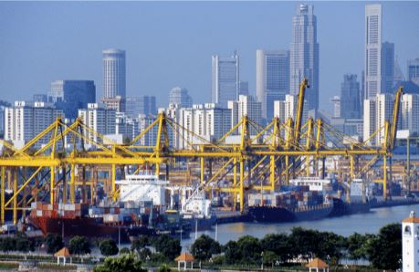
For ports and harbours, the situation is even more complex. Bearing in mind that some 95% of all UK import and export tonnage arrives or departs by sea, every port and harbour requires an efficient and effective infrastructure to keep it moving. And that, too must be paid for, initially by the shipping owner or operator, or by the port authority, but ultimately by the end-user, the consumer. In any port of significant size, users can expect to be pay, on a sliding scale for every registered tonne, or per passenger:
• Berthage fees
• Port conservancy dues
• Pilotage and towage fees
• Light dues to provide for aids to navigation
• Hydrographic charges
• Gangway fees;
• Plant, cranage and labour charges
• Bunkering fees
• Security and allied charges
• Demurrage;
• Waste management charges
• Others, too numerous to mention
Moving goods and people by sea is not cheap.
What of land transport? In recent years, the RIN has increased its involvement in safe navigation for hill walkers and those making their own way around our landscape, using maps and hand-held navigation, and traditional skills. But road transport is rather taken for granted; it is seen as requiring perhaps little in pure navigational skills, thanks to road signage and near-ubiquitous on-board, space-based navigation systems. The road will go where it goes, and you will follow that road. Yet the national and local road network requires massive expenditure on its infrastructure, to keep it in sound working condition, and to keep users safe, just as for air and sea. How we currently do that is different... and perhaps that needs to change. The UK’s road network, some quarter of a million miles in all, is funded by both national and local government, and any development is subject to the labyrinthine planning system, which differs in various parts of the UK. So you may want a new road, or an improved, safer road here, or there, but it will require funding, and national or local governmental approval, and planning permission, often after a lengthy and occasionally obstructive planning inquiry. Bear in mind, too, that local and regional government obtains the vast majority of its funding from central, UK Government.
Some time ago, every vehicle in the UK paid an annual fee–“Road Tax” into the Road Fund, which was set aside for road building and improvements. But that came to an end and, decades ago, Road Tax became Vehicle Excise Duty, a complex and frequently changing sliding scale of charges depending on engine size. Its proceeds, some £7 billion per annum, went directly to the Exchequer for deployment wherever the UK Government wanted. Although there are exceptions. Cars over 40 years old pay no VED at all!

A much bigger tax take from motor vehicles comes from fuel duty, the surcharge you pay to the Exchequer on the fuel you put in your tank. This provides a further sum in excess of £35 billion per annum to the Government. Together, these provide about 4% of all Government tax revenue. And although that provides a large pot for local government to dip into to improve road transport infrastructure and safety, central government, especially in time of financial difficulties, may choose not to make it available. That pot will dry up completely in time, as new petrol and diesel vehicles will be banned from 2030-2035.This system of raising revenue via fossil-fuelled vehicular charges has a number of inbuilt problems, but chief amongst these are the increase in electrical vehicles (EVs) which will pay no VED until 2025, and which will raise only some £1.5billion per annum, but not until 2027/8. Meanwhile, the use of a fuel duty surcharge, as we have now, means that when fuel prices are volatile, as now, any increase in fuel price is exaggerated by the addition of fuel duty and VAT, which means that inflation also ratchets up, but as a result of the Government’s own decisions. We saw with aviation and maritime that at least some of the charges imposed on users are deployed to improve infrastructure and safety. How can we do this in the UK for our creaking road system?...
Tags:
FRIN author
Land Navigation vehicles
road charges
road infrustructure and safety
road tax
Permalink
| Comments (0)
|
|