  
|
Posted By Andy Proctor,
08 December 2022
|
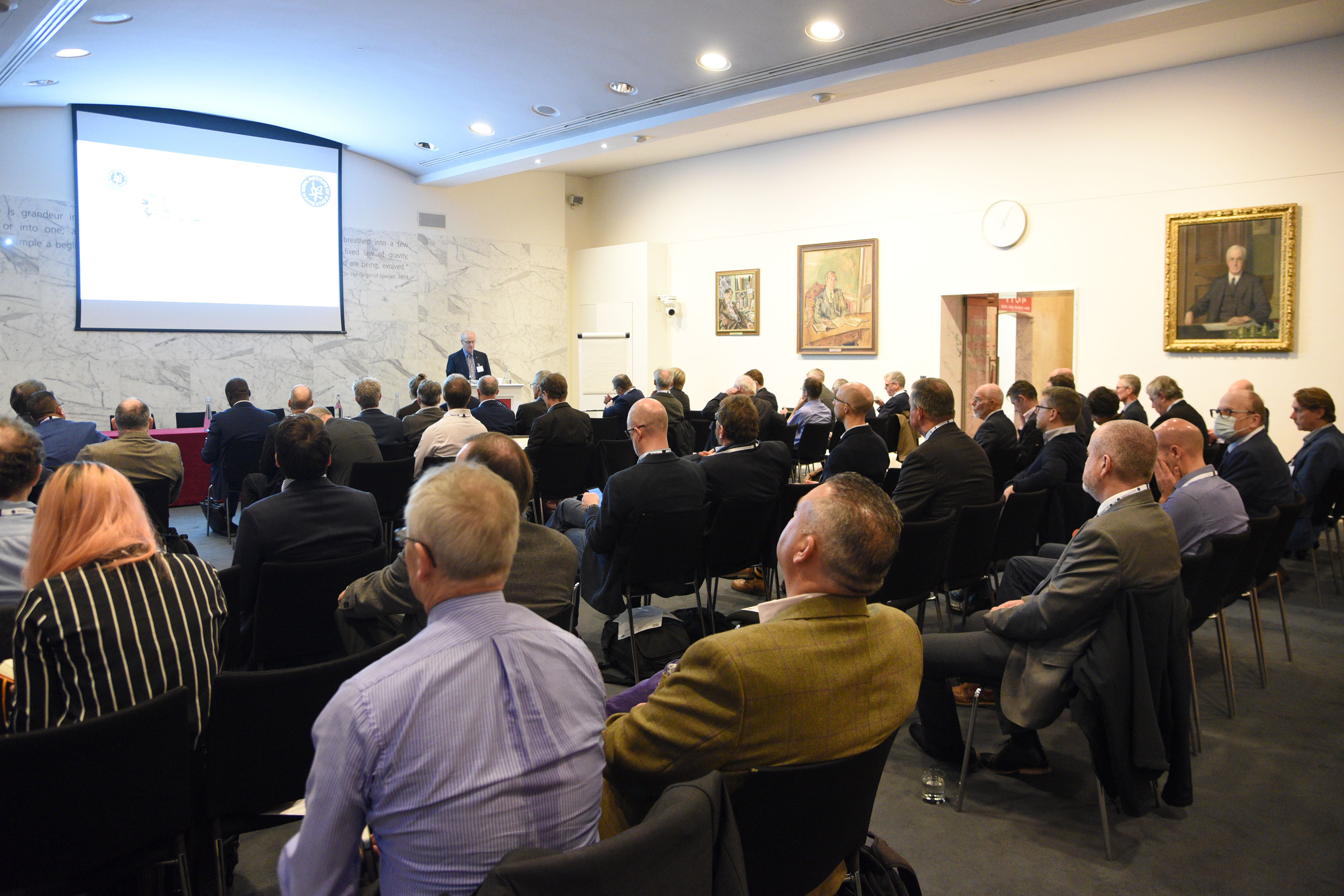
In our inaugural event on the 1st November we hosted around 100 senior Positioning, Navigation and Timing (PNT) leaders from across industry, academia and government at the Royal Society to discuss where PNT is in the UK, where the group thought it needed to be and how to get there. The meeting was held under Chatham House rules.
A primary keynote was given keynote on the economic benefits of resilient PNT to the UK. This reflected a hypothesis that ‘the UK can generate value and sustainable leadership from investing in resilient PNT, benefiting government, academia, industry and, ultimately, individuals.’ The London Economics concept paper that this is based on, which can be downloaded HERE, notes that the UK has significant economic value at risk to even a temporary outage of GNSS, with the road transport, emergency, and justice services, and maritime found to be most precariously positioned.
The London Economics paper continues to assess that major critical infrastructure sectors across the economy remain insufficiently prepared to face the consequences of outages or disruption to satellite-derived time and position, and that backup systems mitigate against the economic value risk.
A recommendation was made that additional work is needed to identify and rank mitigation strategies in order of priority based on strategic and economic factors, that these need to be funded to prove the concepts and that the sector itself should organise itself to present a coherent face to global partners and customers.
This echoed the introductory talks which discussed success being delivered through three functions; [having the right] infrastructure, [putting in place the right] leadership and governance, and [having a pipeline of] skills. The latter being identified through the day as a red flag for all concerned. Examples of open PNT roles were given by delegates, validating the point.
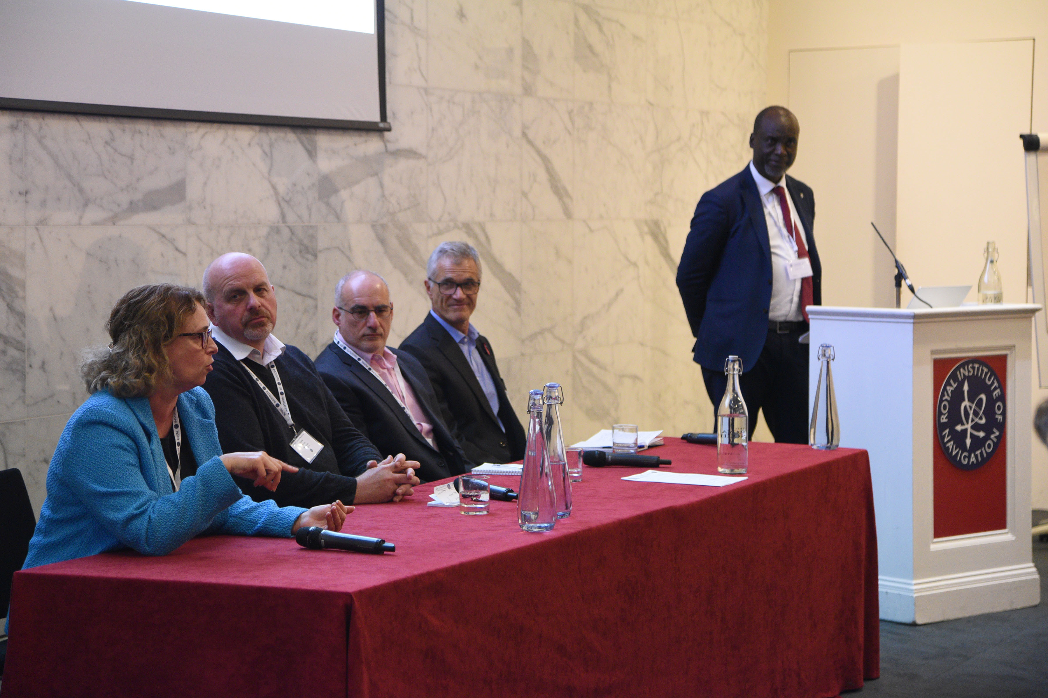
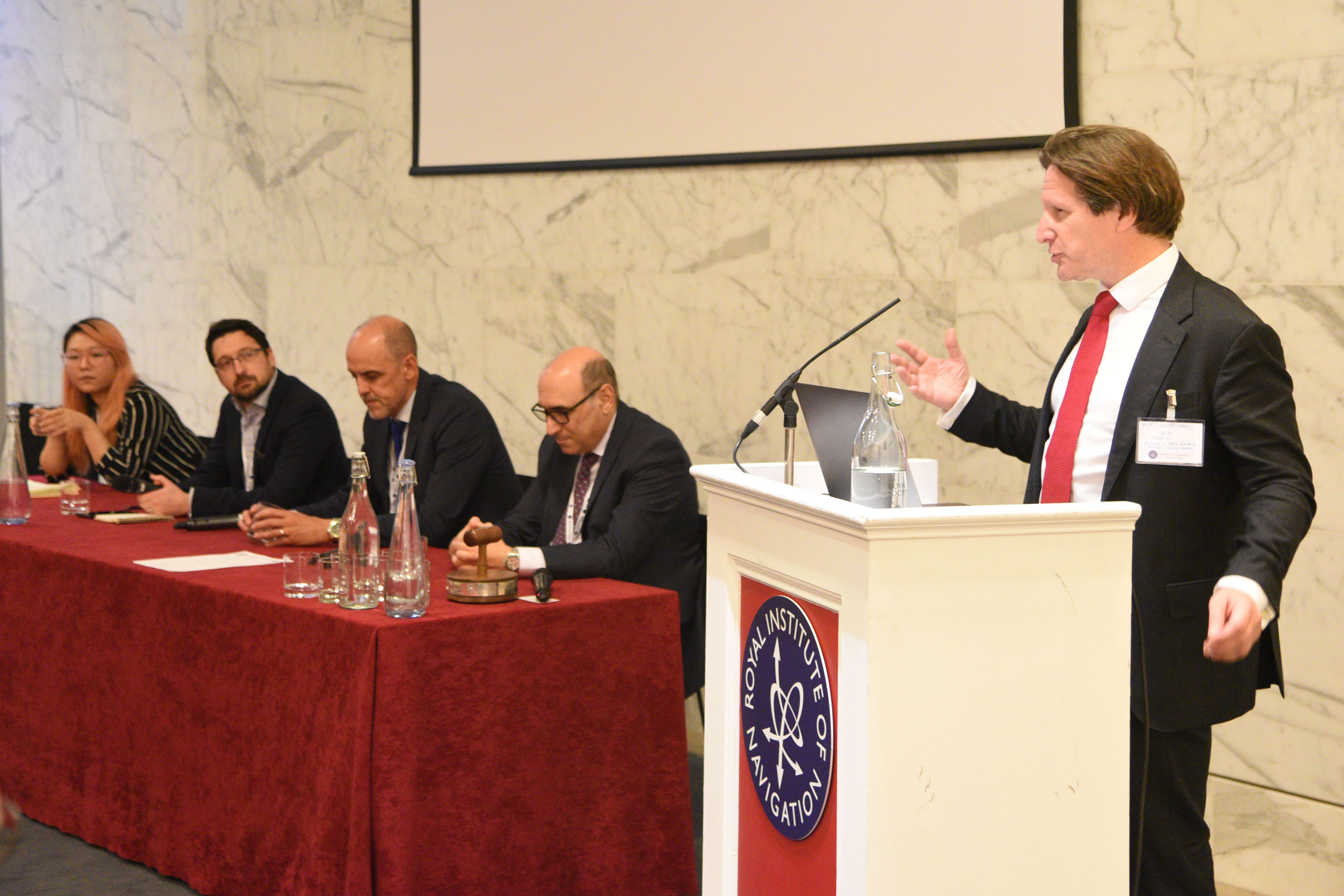
The main focus of the day was two excellent panel sessions, the first focussing on UK strengths, the second being concerned with examples of success but where there is room for improvement. The organisers were aiming for interactive discussion, and this was achieved, with many points being made by the wide range of delegates.
Some of the key messages and points made include:
• the ability to monetise PNT services is a challenge when competing against “free”1 with GPS.
• The role, if any, for better use of legislation, regulation, and standards in resilient PNT – this requires systems thinking and a market focus, moving away from silos that sometimes we fall into.
• The afternoon panel discussed the important point of careers and heard from all panellists about the need to create skills and career pathways from academia [including further education, not just universities] into industry and then structure for CPD.
• Overall, a strong call for co-ordinated action, led by government, on skills to have a greater focus that has been given thus far. It was recognised that individuals will invest their own careers in sectors with high growth and consistent investment. A strong strategy and programme for PNT in the UK would provide impetus and confidence for investment across the ecosystem, arguably reducing government’s own commitment required as well as reducing risks for all stakeholders.
• There was a clear wish for collaboration, particularly on governance and skills. There was a recognition that a range of short, medium and longer term actions will be needed. There was a strong call for RIN to be more proactive, and support for RIN taking leading roles in these areas.
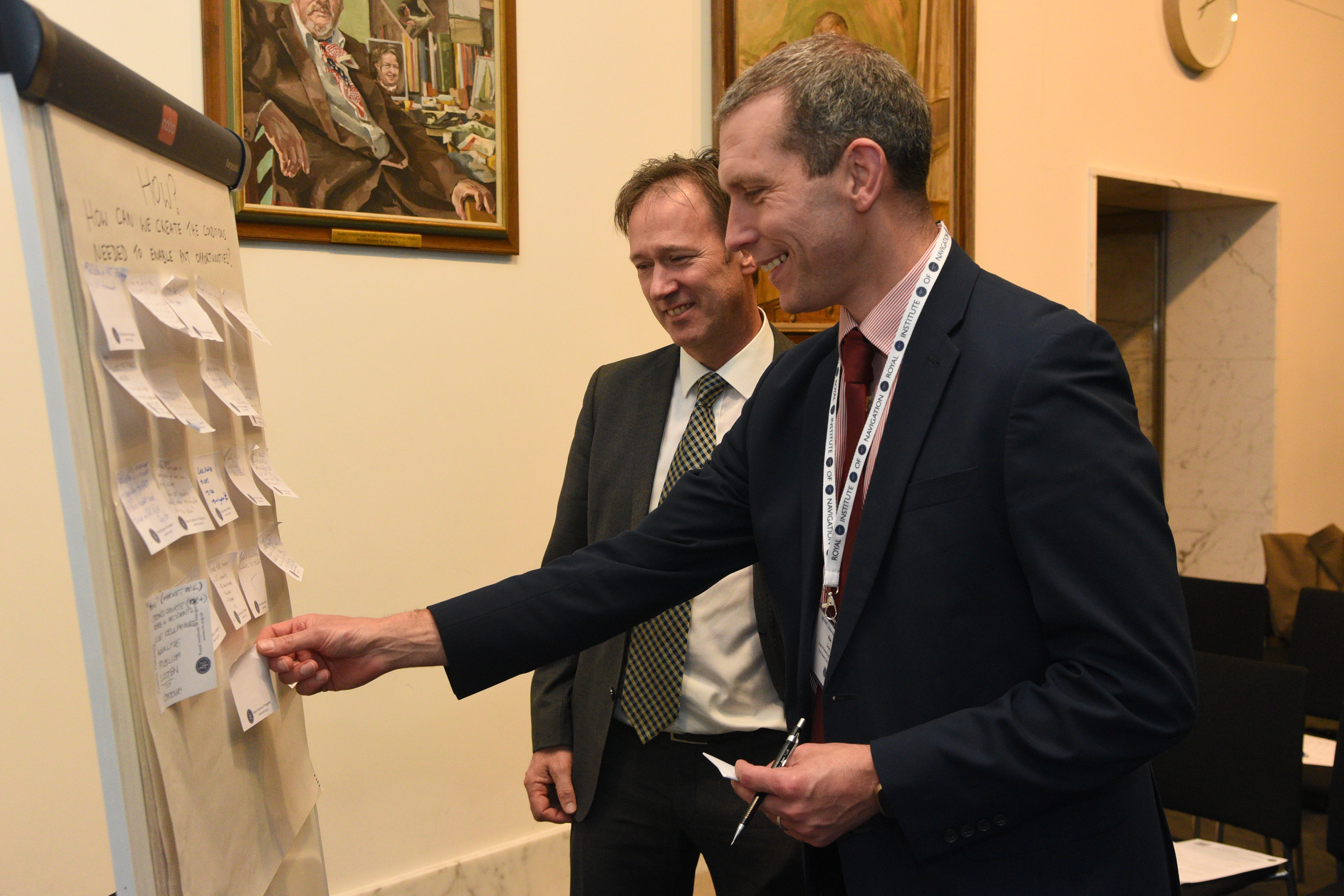
Where the group saw the role of Government was an urgency to announce a strategy and associated governance and programmes. Such leadership and structure itself would build confidence and create/enable the conditions for industrial growth. There were several specific examples cited where the current lack of clear decisions is having real impacts on business decisions, with investment and skills going elsewhere, including overseas. Government leadership and targeted initial investments in R&D and skills, possibly infrastructure too, with a well-targeted legislative approach, would build confidence. This, in turn, would lead to increased investment across the sector, and from individuals wanting to invest their careers in PNT.
There was some discussion on how to support and encourage Government towards strategy and programme announcements. The MoD was cited as a good example where high priority has been given to [resilient] PNT. The attendees also were briefed on US experiences and that a more visible public information campaign and a visible and high-profile champion for PNT in the UK could be helpful.
Overall, the key messages from the meeting are below

What therefore is the role of the RIN in PNT going forward?
The RIN is a learned society and as such is very well-placed addressing long term thinking, strategies and providing input to setting goals with Government. There was a call for the RIN to be the voice of PNT and Resilient PNT in the UK which means not only “helping Government walk backwards over the bridge” but in building the bridge in the first place! The call for RIN to take a proactive and leading role in this way received wide and universal support.
The PNT Advisory Group (PNTAG), a special interest group under the Technical Committee, was warmly welcomed as the place to coalesce the UK’s PNT thoughts and directions but on the condition that it does something and not becomes a YATS (Yet Another Talking Shop). To that end I, in my summing up showed the PNTAG’s plan of action:

The immediate task for the PNTAG is to update this workplan2 to reflect the outcomes from the event and the community input.
Next will be to act on the plan and show that the RIN can deliver on leadership, long term thinking, support our colleagues in Government and to provide advice/guidance to the sector. We agreed we will plan to hold a repeat event around the same time next year where we will track progress – holding ourselves to account! The enthusiasm in the room on the day certainly gave me confidence that the plan is achievable.
To summarise and to channel one of the speakers’ comments a little, the takeaway for me is that for PNT in the UK, we have all the ingredients of success and growth, but need the recipe and hunger to cook the meal.
Our job is to pull the recipe for resilient PNT together and create the hunger for its implementation.
I would like to end with a call offers to contribute to the various work streams – please do get in touch with me if you are able to support this work.
Andy Proctor, MA CEng, FRIN, FIET
Chair, RIN PNT Advisory Group
[1] I know implementing GNSS services is not strictly free, but GPS is free to access, which is what I mean.
[2] If any readers would like information on any of the workstreams, I would be pleased to receive questions. (andy.proctor@rethinkpnt.com)
Tags:
PNT
position navigation and timing
resilient pnt
Permalink
| Comments (0)
|
|
|
Posted By Kim Fisher,
16 November 2022
|
This was a full length eight-day meeting of the Committee and the first meeting since the pandemic to be conducted as a physical meeting in the IMO building and was very well attended. Remote access was also possible. The Chair was Mrs Mayte Medina of the USA and there was again a very heavy workload but the easier meeting arrangements facilitated very good progress to be made including dealing with the backlog after the years of remote working.
The previous meeting of the sub-committee on Navigation, Communications, Search and Rescue (NCSR) held in June had considered difficulties raised by Ukraine of managing Search and Rescue operations in warzone areas and requested developing suitable provisions at this meeting. This was achieved with the drafting of a resolution to remind Member States of their responsibilities under the SOLAS and SAR Conventions in the context of armed conflicts.
Work continued on Maritime Autonomous Surface Ships (MASS) towards developing a MASS Code for cargo ships. A Correspondence Group reported on its work and a meeting had been held of a Joint MSC/LEG/FAL working group incorporating the Legal and Facilitation Committees. It is intended that the Joint working group will now meet twice a year and the Correspondence Group will continue with its work.
A new resolution was agreed on Recommended cooperation to ensure the safety of life at sea, the rescue of persons in distress at sea end the safe disembarkation of survivors.
A new SOLAS chapter XV was adopted on Safety measures for ships carrying industrial personnel together with an associated Code.
The previous meeting of NCSR had considered the application by China for the recognition of the BeiDou Message Service System (BDMSS) for use in the Global Maritime Distress and Safety System (GMDSS). A technical assessment had been performed by the International Maritime Satellite Organization (IMSO) but it had not been possible to complete this for lack of an on site inspection which had not been possible due to the pandemic. An on site inspection had been conducted subsequently which was reported to the meeting. The meeting decided to accept this and agreed to recognise the Chinese system. There are still issues regarding the radio frequencies however to be resolved before BDMSS will be able to operate along side Inmarsat and Iridium.
The NCSR meeting had also completed revised performance standards for the electronic chart display and information system (ECDIS) to facilitate the introduction of the new S-100 electronic charts. An input to this meeting from China suggested deferring the approval of 1 January 2029 as the mandatory application date of the new ECDIS. However this was not accepted by the committee.
New work items were agreed for a revision of SOLAS V/23 on safety of pilot transfer arrangements, and a review of SOLAS IV/5 on provision of radiocommunication services. A proposal to amend SOLAS in order to allow coastal States to receive Long Range Information and Tracking (LRIT) information free of charge was not accepted. As a consequence of a report of the UN Panel of Experts regarding the Democratic People's Republic of Korea (DPRK), NCSR was tasked to carry out a review of security standards for preventing the tampering of AIS transponders used to disguise illicit oil deliveries.
The meeting noted the recent death of Christian Breinholt of Denmark who was MSC chair from 2012 to 2015. The meeting bade farewell to Captain Moin Ahmed the Director-General of IMSO who was ending his term after 8 years. The new Director-General will be Laurent Parente of Vanuatu.
The next meeting has been scheduled for 31 May to 9 June 2023. A meeting of the IMO/ITU Joint Experts Group has been scheduled for 5 to 9 December 2022. The next meeting of NCSR is scheduled for 8 to 17 May 2023.
Tags:
IMO
International Maritime Organization
maritime
safety
Permalink
| Comments (0)
|
|
|
Posted By John Hasselgren,
14 November 2022
|
Hydrography at the Port of London Authority
- Talk by John Dillon-Leetch, Port Hydrographer
Report by John Hasselgren
This fascinating and informative talk was given as one of the Small Craft Group’s collaborations with the Royal Thames Yacht Club.
John started by giving a brief synopsis of his journey from sailing on the West Coast of Ireland, becoming a Yachtmaster, then working in offshore oil and gas before joining the PLA and working up to his present position as Port Hydrographer.
We were then informed a that London was a Trust Port covering 400 square miles, with 95 miles of the river and its estuary and 70 wharves and terminals. By tonnage, 50 million per annum, it is the UK’s largest port. West of London the river is mainly used for recreation, the centre, in London, is mostly used as a road with 90 million passenger journeys, while east of London it is mainly commercial.
The PLA has a Vision Document for the desired future of the Thames, Thames Vision 2050. Here it sets out how it wants the Thames to develop under three main headings:
Trading Thames. Here it looks to be a competitive port, close to the UK’s largest market. Improved connectivity with road and rail infrastructure is its aim, with innovative solutions to expand the use of the river as a means of transporting varied light freight into central London instead of using the roads.
Destination Thames. The river needs to be accessible to all, with visitors drawn to it as the best way to enjoy London with its cultural attractions, and to use its leisure facilities.
Natural Thames. The aim is to have a clean river, free from sewage, waste and pollution supporting greater biodiversity and recreation. It should be valued for its clean air and wildlife as well as being a natural flood defence and carbon sink. More people should be living, working and taking relaxation around the river.
Moving onto the role of Hydrographic Services John described it Statuary Duties. These included the provision of charts for the safety of navigation, data analysis and mapping, provision of river advice and commercial survey work. Who needed these services? Mariners, Harbour Masters, Pilots, terminals and stakeholders. The challenges? Trade growth, available depths, the transition to digital charting, advances in technology and climate change.
Ship owners want their vessels to carry the maximum amount of cargo. This increases draft and minimizes under keel clearance. If insurers agree, this is usually 10% of the ship’s draft. An increase in the accuracy of surveys, leading to perhaps an extra 10cm of water could result in an extra 10,000 containers moving up the river.
Climate change could be a blessing with higher rainfall and rising sea levels leading to a reduced need to dredge. On the other hand it could also lead to extra water running down the river, with overload on the sewer system and increased pollution. Hence the need for the super sewer being built along the Thames beneath the river.
Pilots have their own electronic carry on board system, with the latest PLA charts. The PLA already has 160 pilots and is currently recruiting 16 new pilots a year to allow for natural losses and expected increase in demand. The surveying of the various channels was required to allow pilots to plan safe passage for vessels, making sure there was a safe UKC along the whole of the expected route. This would often require a vessel to reduce speed to allow the tide to rise sufficiently for the draft + 10% rule. To assist this we learnt that the tide heights from tidal gauges were broadcast regularly, together with any deviation from predicted heights. Next year it is expected that dredging will cost up to £200 million. Data recording is important as it allows comparison with earlier surveys indicating which channels are stable and which are likely to require dredging. Bringing a ship up the Thames, perhaps from the Sunk to its berth, is a bit like driving a heavy goods lorry up a motorway where the width of the road halves and bridge heights reduce by 6 metres every six hours.
To assist with the survey work the PLA has three vessels, Maplin, Thames and Galloper. The latter, Galloper, is capable of being loaded onto a trailer meaning that she can be transported to conduct surveys in other waters. Until 1991 all positions were fixed by horizontal sextant angles as GPS was considered too inaccurate for serious survey work. Since then GNSS has been used. In addition to these vessels, new technology is being introduced in the form of remotely controlled or autonomous small vessels, surface or sub-surface, and drones. The side scan sonar equipment can be moved from one to the other. As John Dillon-Leetch explained, the equipment may be fitted into a vessel costing £1.5 million or an AV costing £8 thousand. The AV, he said, needed no crew accommodation, galley nor heads. Also, they are quiet, non-polluting and the data is available in real time.
Responding to a question John explained that the PLA’s jurisdiction extended from Teddington down river and out east to the Gunfleet Sands, south to Margate Sand then west to the Isle of Sheppey.
Moving on to charts, the PLA produces its own portfolios of A2 size charts of the river and estuary which may be purchased. There are also charts at much larger scale for use in work areas or ships’ berths. These may be viewed on the PLA web site, which is well worth checking out.
As a finale we were shown scans of some of the Estuary’s sunken vessels including the steel barque Dovenby which sank in 1914 with a cargo of guano. Also shown was the SS Richard Montgomery off Sheerness which still contains a cargo of explosives from the 2nd. World War. She is surveyed regularly to check the state of the deck; the masts are currently of concern and there are plans to cut them down before they fall. Just to prove that the PLA do sometimes work on contract to other authorities and businesses we saw a survey of the remains of the power station wall at Bradwell Power Station on the River Blackwater.
Tags:
hydrography
leisure sailing
maritime
small craft group
Permalink
| Comments (0)
|
|
|
Posted By Administration,
03 November 2022
|
Early November 2022 will see geospatial history being made when true north, magnetic north and grid north combine at a single point in Great Britain for the first time ever.
According to calculations made by Ordnance Survey (OS), Great Britain’s national mapping service, the historic triple alignment will make landfall at the little village of Langton Matravers just west of Swanage in early November and will stay converged on Great Britain for three and a half years as it slowly travels up the country.
The three ‘norths’
As expert map readers will know, when you’re navigating with a compass there is a difference between magnetic north (where the compass points) and grid north (the vertical blue grid lines shown on OS maps).
Grid north is the blue lines on an OS map that either points directly to, or near to the North Pole, whereas true north is the direction of the lines of longitude that all converge at the North Pole. Across OS maps true north varies from grid north since it reflects the curve of the earth, except on one grid north line, which aligns with longitude 2 degrees west of the zero Greenwich meridian line. Anywhere on this ‘special line’ grid north and true north align.

Image 1: The ‘special line’ as it runs through Great Britain
Magnetic north marks the northward line to the magnetic North Pole. The position of the magnetic North Pole and the direction of magnetic north moves continually due to natural changes in the Earth’s magnetic field.
After always being to the west of grid north in Great Britain the last few years have seen magnetic north move to the other side of grid north. The change started in 2014 at the very tip of Cornwall and is slowly moving west to east across the country. It is now reaching the ‘special line’ and will incredibly converge with the other two ‘norths’ for the first time in history.
After making landfall at Langton Matravers, the triple alignment will pass northwards through Poole by Christmas and then Chippenham and Birmingham before reaching Hebden Bridge in Yorkshire in August 2024. It will pass though the Pennines before leaving the English coast at Berwick-Upon-Tweed a year later in August 2025 and it does not hit land again until around May 2026 at Drums, just south of Newburgh in Scotland. After passing through Mintlaw its last stop in Scotland and the landmass of Great Britain is Fraserburgh, around July 2026.
Due to a number of factors these predictions are likely to change, but only by a few months. Factors include updated magnetic field observations from the British Geological Survey (BGS) due to changes in the flow of iron in the liquid outer core.
Mark Greaves, Earth Measurement Expert at Ordnance Survey, said: “It is no exaggeration to say that this is a one-off event that has never happened before. Magnetic north moves slowly so it is likely going to be several hundred years before this alignment comes around again.

Image 2: The ‘special line’ over Langton Matravers, Dorset
“This triple alignment is an interesting quirk of our national mapping and the natural geophysical processes that drive the changing magnetic field.
“But for navigators the same rules will apply whether they are simply on a trek or a walk or flying planes or navigating ships at the other end of the spectrum. They will always have to take account of the variation between magnetic north from a compass and grid (or true) north on a map.”
As part of its long-running collaboration with OS, the BGS geomagnetism team makes detailed measurements of the magnetic field at 40 sites around the UK. These enable scientists to create high-resolution maps and to make accurate forecasts of the changing declination angle.
Dr Susan Macmillan, of the BGS said: “This is a once in a lifetime occurrence. Due to the unpredictability of the magnetic field on long timescales it’s not possible to say when the alignment of the three norths will happen again.”

Image 3: The ‘special line’ passing through Hebden Bridge, Yorkshire
Press release from Ordnance Survey
This post has not been tagged.
Permalink
| Comments (0)
|
|
|
Posted By John Hasselgren,
21 October 2022
|
This joint collaboration between the Small Craft Group and the Royal Meteorological Society was held this year at the RNLI Lifeboat College in Poole. It was run as a hybrid event with delegates able to attend in person or to view it on line. Unfortunately, in the event, a rail strike on the day caused a low attendance in person at the College, with some of the SCG people being unable to return home and having to stay an extra night. What we do for RIN!

Paul Bryans and Prof Liz Bentley welcome the audience to Weather and Sailing 2022
The weather also joined the event by showing its great variety, with high winds and rain on the preceding night, mist clearing to sunshine during the day, followed by a front bringing in more rain during the evening. For those who had pre-booked there was a limited tour of the College facilities; although not the full tour it still allowed a visit to the simulator which allowed the visitors to experience the foul conditions under which RNLI crews sometimes have to work.
During the day we heard from Richard Falk of the RYA that they had no influence over the weather, but that they could influence training for yachtsmen (and, of course, women). Past training had concentrated, he felt, on official forecasts and was overburdened with definitions. Recently the RYA had changed to a more dynamic approach with less emphasis on memorizing numbers and more on understanding how the weather developed, and combining forecasts from various sources. However, Richard did warn against shopping amongst many forecasts until the desired one was found. Sailers should be aware of different sources of weather information but understand the merits of official and unofficial forecasts. This fitted well with the review of Standards of Training, Certification and Watchkeeping (STCW) for professional mariners that was currently recommending a greater balance between the use paper and paperless systems. There was also a similarity here with the changes happening in navigation with the UKHO ceasing all production of paper charts.
Christian Dumard described the Squid weather routeing software, with its ability, if I understood correctly, to merge different sets of weather information in GRIB file format, and then to produce a weather routed passage plan. It has the capability of producing a chart of isochron lines detailing all the locations the yacht is able to reach at any specified time as well as a table showing wind speed and angle together with boat speed. A warning was given that the program assumes that the vessel will be in smooth water, that the boat is light and the crew up to windward. The resolution can be adapted to the length of the passage, thus allowing higher resolution for coastal sailing compared with ocean crossing.
Ronan Boyle from Irish Lights ended the morning session with a description of the trials they are undertaking with weather reporting from Metocean buoys. Met Éireann already operate several weather buoys, but these are mostly well offshore and are good for detecting weather patterns. Irish Lights buoys are positioned in inshore waters in areas where Met Éireann would like extra data. Even so they are likely to be in deep water, from 30 to 100 metres, with all chain moorings with a submerged float part way down to support the weight of the chain. Being free to swivel, some of the buoys have a metal sail to allow them to orient with the wind. The navigation light has a wider vertical spread than normal to allow for movement of the buoy. Comparison with these Irish Lights buoys and the Dutch Datawell Waverider buoys showed good correlation for wave heights but gave a wider range of values for direction. This has led to a second set of tests being done.
Simon Rowell from British Sailing Team started the afternoon session by describing how he was able to interpret a forecast to give accurate local area information. A photo of Tokyo Bay with Mount Fiji in the background showed several different layers of haze and cloud which aided the micro forecast for the racing. Using a synoptic chart of Europe, on which Simon’s Cornish home was marked, showing a low and two fronts Simon said that as the first front passed the sky should clear to sun; with straight isobars behind the front the wind should remain from the same direction. Satellite images from 07:00 showed the front just to the West of Cornwall. By 13:00 the satellite image indicated a brightening up. GRIB data then showed the wind veering at 13:00. (The old saying, “Rain before seven, fine by eleven” would seem to cover this. Ed.) Unfortunately the GRIB files aren’t sufficiently detailed to show what happens round headlands where the wind can swirl and accelerate. Looking at Rio de Janeiro the GRIB files fail to notice the conical rock that influences the wind in the entrance, whilst around Castle Rock in Falmouth, with the wind accelerating, there is still a small calm area right inshore.
Adam O’Neill, RNLI Instructor, gave details of the RNLI’s current range of lifeboats and the weather conditions in which they were considered safe to use. The D class ILB could be out in slight to moderate conditions at night, moderate by day. It also had a three hour limit due to the amount of fuel it carried. The B class Atlantic could be deployed in moderate to rough conditions at night and rough by day. With both these boats being launched from a trailer, perhaps with a tractor, the stern first recovery was made more difficult with onshore winds. The all weather lifeboats have no limits imposed by the conditions. Adam then showed the drogue carried by all weather boats used to give directional stability to a towed casualty, especially when being towed downwind. Adam ended with some sensible advice to those needing rescue: Don’t endanger yourself: Inform the Coastguard: Listen to the lifeboat cox’n: Tidy the boat, stow away spare un-needed gear.
Chris Kobush and Sophie O’Neill next gave us an insight into sailing in high latitudes, both the Arctic and Antarctic. One of the weather hazards encountered will be ice. In the Arctic the need to check ice conditions is helped by consulting the weekly ice charts published by the Canadian Met. Office. There are three stages to plan for. Firstly, the ocean passage. On this, icebergs which have calved off glaciers may be met. These require a good look-out, including the use of radar, especially at night. Secondly, the offshore approaches. The ice is likely to be pancake ice and broken sea ice. This can develop into cat ice which can trap a vessel. Thirdly, inshore navigation. Growlers and bergy bits are the type of ice met with here. These can pile in after a vessel has passed through them into an anchorage and trap her. On navigation charts there are relatively few soundings, especially in coastal waters which may have been beneath ice until recently. A steel boat is able to withstand knocks and pressure, and a lifting keel and rudder will help prevent ice damage while at anchor. Satellite images of likely anchorages are useful, and can be confirmed with reconnaissance by dinghy and drone. In fog, there is little likelihood of meeting other vessels, but icebergs are a worry. Surface temperature charts can be downloaded and it is possible to heave to and wait. Pressure charts are useful in predicting heavy weather as is regular logging of barometer readings. Look at cloud patterns – “Mare’s tails and mackerel scales make tall ships carry low sails”. Katabatic winds can come down mountainsides. Snow and ice on deck cause slipperiness and stability worries while driving snow reduces visibility.
Our final speaker was Ian Rivers from Row Sentinel. What an adventure! Ian served in the army and the SAS for more than 20 years. As a civilian he worked as a security adviser in Syria until captured by rebels and held for six days. He escaped whilst being transferred to a new location when a different group of rebels ambushed his original captors, and then walked to Turkey using natural navigation techniques that would be approved by Tristan Gooley. To commemorate his release and raise money for service charities he decided to row single handed and unsupported from New York to the Isles of Scilly. He also eschewed GNSS, relying on old fashioned techniques. Training at Plymouth University with scientists and sports psychologists, the Covid pandemic interfered and delayed the project until the summer of 2021. Simon Rowell (see above) helped with weather predictions, finding a three day window with offshore winds that would get Row Sentinel well away from coastal traffic on the American continental shelf. Using dead reckoning in the absence of any visible sun, it was ten days before Ian was able to get astro sights, which he found difficult to take from a small craft. His position was then within 100 nautical miles of his DR. Getting better at this, Ian was able to send regular sight positions to the shore team after three weeks. Row Sentinel was hit by a storm that caused damage to the craft and injury to Ian. The storm was predictable, but the 90˚ wind shift that accompanied it led to a very confused sea. The vessel was flooded and listing heavily to port. Remembering the Serenity Prayer, “God, grant me the serenity to accept the things I cannot change, courage to change the things I can, and wisdom to know the difference.”, Ian managed to gradually empty the boat and continue the journey without the electronic instruments that had been put out of action, leaving him with only the compass, autopilot and a radio. Each day he was given the bearing from his position to the Isles of Scilly and eventually made it in 85 days, 22 hours and 59 seconds.
All in all, a varied and interesting day. Thanks must go to the RNLI which allowed the use of the Lifeboat College, Dr. Andrew Eccleston who set up and controlled the on line viewing for those unable to be present and to the Royal Meteorological Society in the person of the Chief Executive, Prof. Liz Bentley, for combining with RIN to run this event.

Tags:
leisure vessels
small craft group
weather and sailing
Permalink
| Comments (0)
|
|