  
|
Posted By Clare Stead,
31 July 2024
|
Register Your Interest Now:
SALHUB Training Courses for PNT, EO and SatComms
The Space Applications Learning Hub (SALHUB) is one of five new projects recently announced by the UK Space Agency (UKSA) to help tackle key skills gaps identified by the recent UK space sector skills survey. This UKSA funding has been provided to boost the availability of training and to break down barriers to opportunities within the fast-growing, high-tech sector.
The SALHUB is led by the Royal Institute of Navigation (RIN) together with expert partners Space Professionals Partnership Limited (SPPL), Geospatial Ventures Limited (GVL) and Space Skills Alliance (SSA).
This project will deliver expert-led training modules in systems engineering, data/artificial intelligence (AI)/machine learning (ML) and commercial operations across positioning, navigation and timing (PNT), Earth observation (EO/GIS) and satellite communications (SatComms).
Training across these three domains of PNT, EO and SatComms will be delivered both online and in-person. Online training will be delivered between 30 September and 6 December 2024 (see initial schedule below), and in-person training will be delivered in early 2025, with a 5-day course for each domain.
All courses during the grant period are open, available to all and free to attend. All courses, particularly the in-person courses, may well fill quickly so please register your interest here to be first to hear when booking opens.
Expert-led Training
The RIN is a widely respected UK learned society and professional body. RIN domain experts supported the work resulting in the October 2023 Policy Framework for greater PNT resilience.
The SALHUB project will build upon the RIN’s acclaimed earlier PNT training by introducing domain experts GVL and SPPL to develop high quality training courses for PNT (led by RIN), EO (GVL) and SatComms (SPPL).
Positioning, Navigation and Timing (PNT) Training
PNT enables all aspects of everyday life, from smartphone apps to enabling critical infrastructure such as communications and power networks. PNT is a growing area and our courses are designed for anyone considering moving into a sector using PNT, anyone who has just made that move, or indeed those wanting new insights and to deepen PNT skills. Courses will be offered at foundation and intermediate level.
The foundation courses will provide a vital bedrock of awareness and knowledge needed by everyone involved in using or specifying positioning or timing as part of a system or application. Intermediate level courses go deeper, into system engineering design, data analytics for PNT systems and how to interpret and apply PNT data, including use of AI/ML techniques.
In a little more detail: the PNT course initial delivery will span a series of webinar sessions to be delivered in late 2024 (see dates below) and will address how to write positioning and timing system specifications for any use case, best practices for resilient PNT, a review of data sources, types of data and outputs from positioning and timing systems, interpretation and analysis of PNT data and a special module on timing. There will be modules on bringing everything together into a system-of-systems capable of performing resiliently. We will also cover how to track and maintain performance for your use case, flagging issues and how to plan to address them.
In early 2025, the PNT courses will be also delivered in a week-long block in-person in London, where the above modules will be complemented by additional hands-on workshops and using real data sets and tools.
Earth Observation (EO) & Graphical Information System (GIS) Training
EO and GIS are an integral part of the operations of a wide array of organisations. These skills are increasingly in demand across the widest range of sectors & span disciplines from understanding online mapping systems & environmental monitoring to urban planning. Our EO and GIS courses are designed for anyone considering moving into the space or indeed anyone with a desire to understand the use and applications of EO and GIS. They are also relevant to people seeking new insights or those who are keen to deepen the EO and GIS skills. Our courses will be aimed at foundation skills with learning moving to intermediate levels at later stages.
The Earth Observation and GIS Training is a modular course providing both an overview of EO and GIS and detailed insights into EO and GIS systems and applications. The foundation level will include an Introduction to EO and GIS, covering an overview of EO and GIS, their uses and benefits, and different configurations (including satellite-based EO and GIS software).
More detailed modules will include Data Acquisition and Sources, covering the types of EO data (optical, radar, thermal) and GIS data sources (spatial databases, remote sensing, field surveys); Data Processing and Management, focusing on preprocessing EO data and managing GIS data; and System Specifications and Design, discussing how to write EO and GIS system specifications and design resilient systems. Further modules will explore Data Interpretation and Analysis, remote sensing techniques, AI/ML in EO and GIS, Performance Monitoring and Maintenance, and practical workshops using QGIS with Copernicus data. The course culminates with a module on System Integration and Application, considering technical and societal benefits of EO and GIS.
The initial online webinar course delivery will take place in late 2024. In early 2025, the course will be delivered in a week-long in-person training programme, including all the above modules, additional hands-on workshops, and real datasets and tools.
Satellite Communications (SatComms) Training
SAL-HUB will offer a modular course providing both an overview of Satellite communications and some detail in terms of Satcom systems and business needs. The foundation level will include an Introduction to Satellite Communications covering an overview of uses and benefits, and different configurations (including low earth orbit and geostationary).
More detailed modules will include Use Cases to Requirements covering an understanding of common use cases for Satcom; Regulation & Standards; Satcom System Design including satellite capacity, ground segment system management and related services; network design and link budgets; Management Systems; 5G & Satellites; System Design and Business Requirements and Techno-Economic Analysis considering technical and societal benefits of SatComms.
Cross-Cutting themes in System Engineering, Data/AI/ML and Commercial Operations
Before the PNT, EO and SatComms courses begin, there will also be an introductory week of cross-cutting content that explores systems engineering, data/AI/ML and commercial operations. These sessions will cover foundational modules that will act as a leveller for attendees coming from different sectors.
The System Engineering modules will include focus on system engineering from a space industry perspective and include an Introduction to Space System Engineering; System Context, Requirements and Design; and System Verification, Validation and Qualification.
The Data/AI/ML modules will focus on an introduction to the concepts of AI and ML from the perspective of the space industry. They will include an introduction to AI and ML, satellite & space data contexts, data processing and also introduce task setting including supervised learning, un-supervised learning and reinforcement learning.
The Commercial Operations modules will provide an introduction to commercial skills aimed at space industry professionals. They will cover an overview of developing a Product and Service Strategy, Product and Service Launch and Access to Finance aimed at the space industry.
Online Training Dates
The Cross Cutting Theme online sessions are planned for delivery from Monday 30 September to Friday 4 October, with 90-minute online sessions being held at 1100-1230 BST and 1300-1430 BST throughout the week.
The PNT course online sessions are planned for delivery from 1100-1230 BST (GMT after 27 Oct) every Monday from 7 October to 25 November.
The EO course online sessions are planned for delivery from 1100-1230 BST (GMT after 27 Oct) every Wednesday from 9 October to 27 November.
The SatComms course online sessions are planned for delivery from 1100-1230 BST (GMT after 27 Oct) every Friday from 11 October to 6 December.
Course Registration
The final touches are currently being made to the courses before we make them live to book online – if you’d like to be among the first to hear about it when registration becomes available then please register your interest at: https://rin.org.uk/page/SALHUBTraining
Tags:
Earth Observation
EO
Geographical Information Systems
GIS
PNT
Positioning Navigation and Timing
SatComms
Satellite Communications
Space Skills
Training
Permalink
| Comments (0)
|
|
|
Posted By Hannah Sherrard,
20 June 2024
|
The Royal Institute of Navigation Fellowships and Awards 2024
On 18 June 2024 the Royal Institute of Navigation (RIN) hosted its 2024 AGM and Annual Meeting at the Royal Geographical Society in London. The meeting was chaired by the RIN Director, John Pottle, and welcomed close to 150 RIN members and friends.
During the AGM a series of resolutions were passed, including the adoption of the 2023 Trustees’ Annual Report and the election of the following Council Officers:
- Washington Ochieng as President (read more here)
- Andy Proctor as Vice President
- Martin Foulger as Chair of the Audit and Risk Committee
- James Taylor as Chair of the Membership & Fellowship Committee
- Terry Moore as Chair of the Remuneration Committee
- Members of Council: Tristan Gooley, Alan Grant and John Owen
 |
| Immediate Past President Cynthia Robinson handing over to new President Washington Ochieng |
TopNav 2024 Award Winners
The AGM and Annual Meeting provided the perfect opportunity to celebrate the winners of the recent TopNav, the visual navigation competition run by the RIN’s General Aviation Navigation Group. The award winners for 2024 were:
TopNav Runner Up:
Navigator: Brigid Beney and Pilot: Adrian Beney
TopNav Best Youth:
Navigator: Matthew Whitehead and Pilot: Neil Whitehead
TopNav 2024 Overall Winners:
Navigator: Alice Robinson and Pilot: Simon Cassia

New RIN Fellows
Every year we welcome a new cohort of RIN Fellows and recognise their contributions to the field of navigation. This year, Fellowship of the RIN has been awarded to the following:
- Adam Price - in recognition of leadership to achieve best-practice understanding and use of PNT simulation systems
- Christopher Mather - in recognition of innovative design and implementation of multi-sensor navigation algorithms to improve positioning performance and resilience
- Dana Goward - in recognition of leadership and advocacy for positioning, navigation and timing (PNT) resilience
- David Bartlett - in recognition of multiple innovations in radio positioning and sensor fusion
- Gillian Burns - in recognition of a career dedicated to safe navigation and contributions promoting equality in maritime history
- Marco Lisi - in recognition of contributions to the development of satellite navigation and educational activities promoting a better knowledge of navigation
- Octavian Thor Pleter - in recognition of contributions to air navigation with a focus on the optimisation of flights and air traffic management
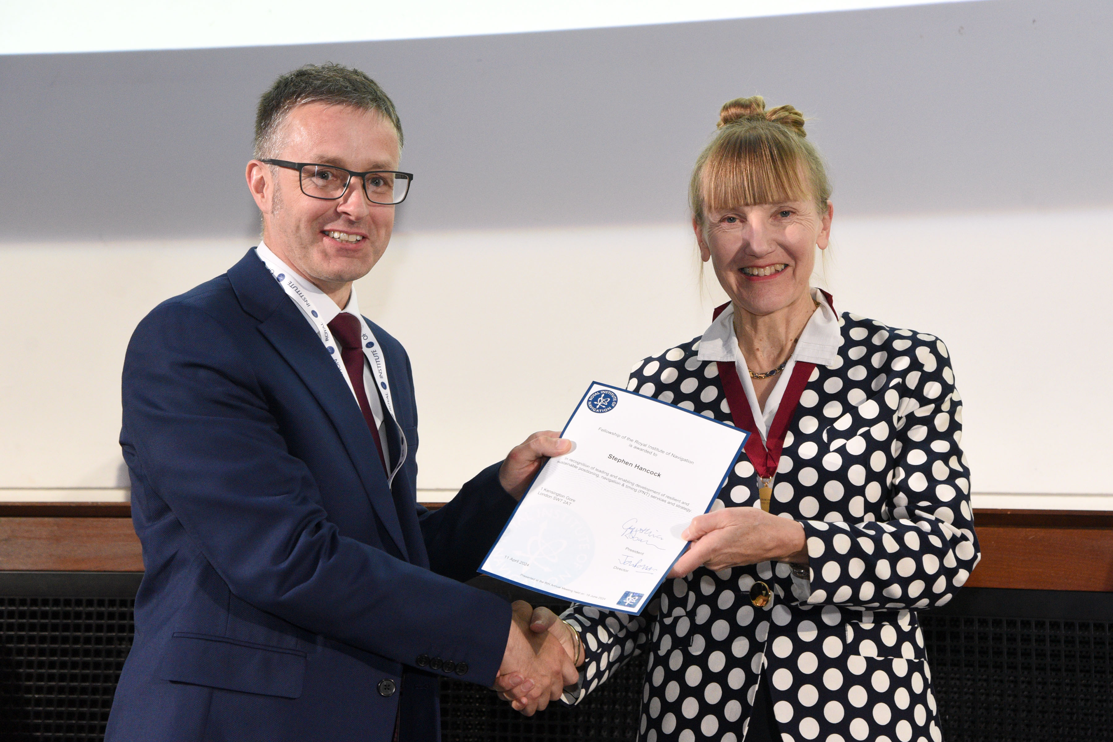
- Stephen Hancock - in recognition of leading and enabling development of resilient and sustainable positioning, navigation and timing (PNT) services and strategy
- Tim McCarthy - in recognition of research in navigation solutions and work as an educator across the geospatial industry
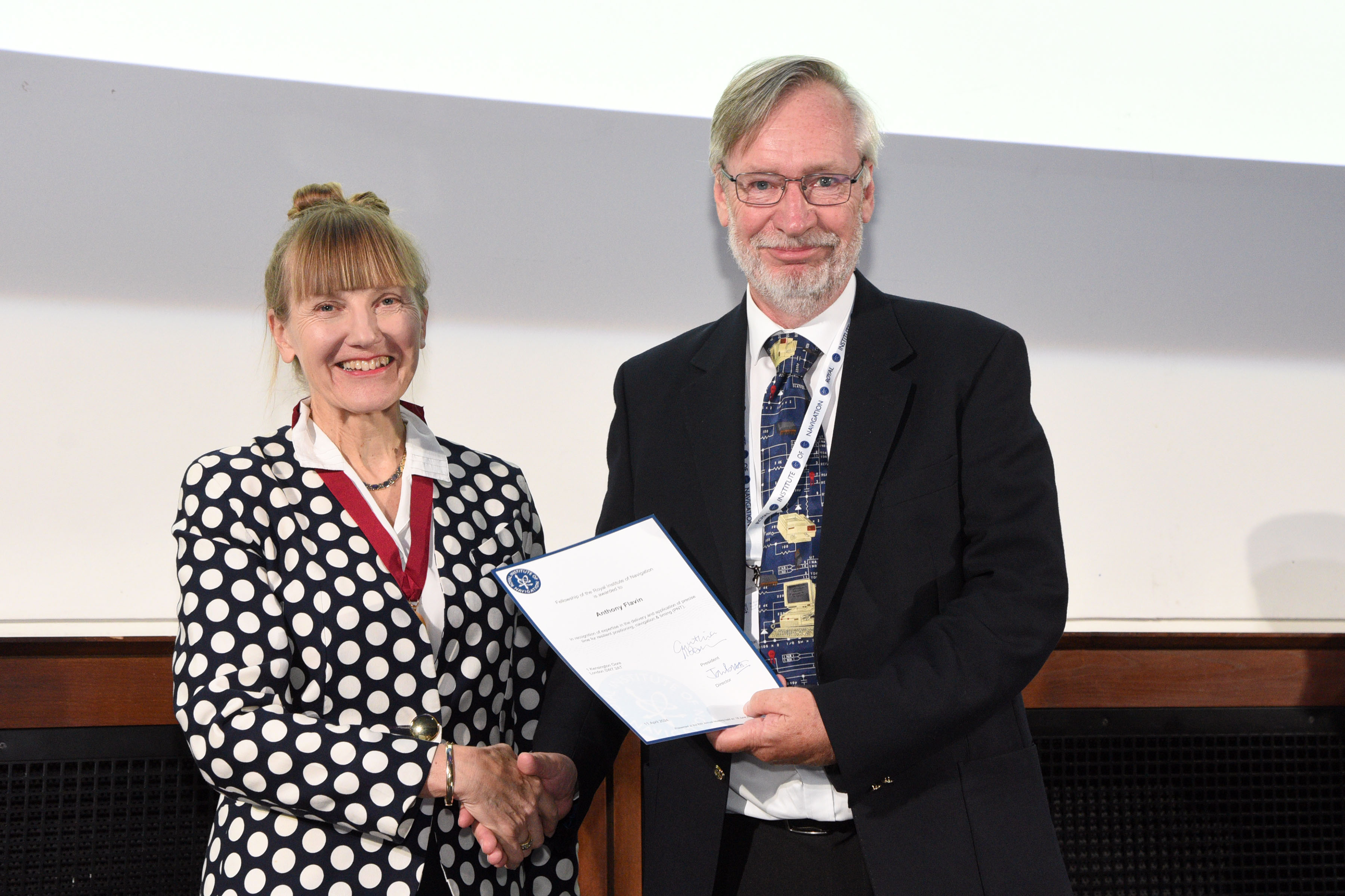
- Tony Flavin - in recognition of expertise in the delivery and application of precise time for resilient positioning, navigation and timing (PNT)
- William Roberts - in recognition of leadership to develop next generation positioning, navigation and timing (PNT) systems and expertise
|
|
|
|
| Tony Flavin receiving his Fellowship Award |
|
|
 |
|
|
| Octavian Thor Pleter delivering this year's invited talk |
|
|
 |
|
|
| Stephen Hancock receiving his Fellowship Award |
|
|
RIN Awards 2024
There were three recipients of the 2024 J.E.D. Williams Medal for an outstanding contribution to the affairs of the Institute:
- Bob Cockshott - in recognition of his work to improve the operation and scope of the RIN Technical Committee
- Serdjo Kos - in recognition of his leadership and support to the RIN and the Croatian Branch
- Simon Gaskin - in recognition of continuous outstanding contributions to the RIN Council over 22 years
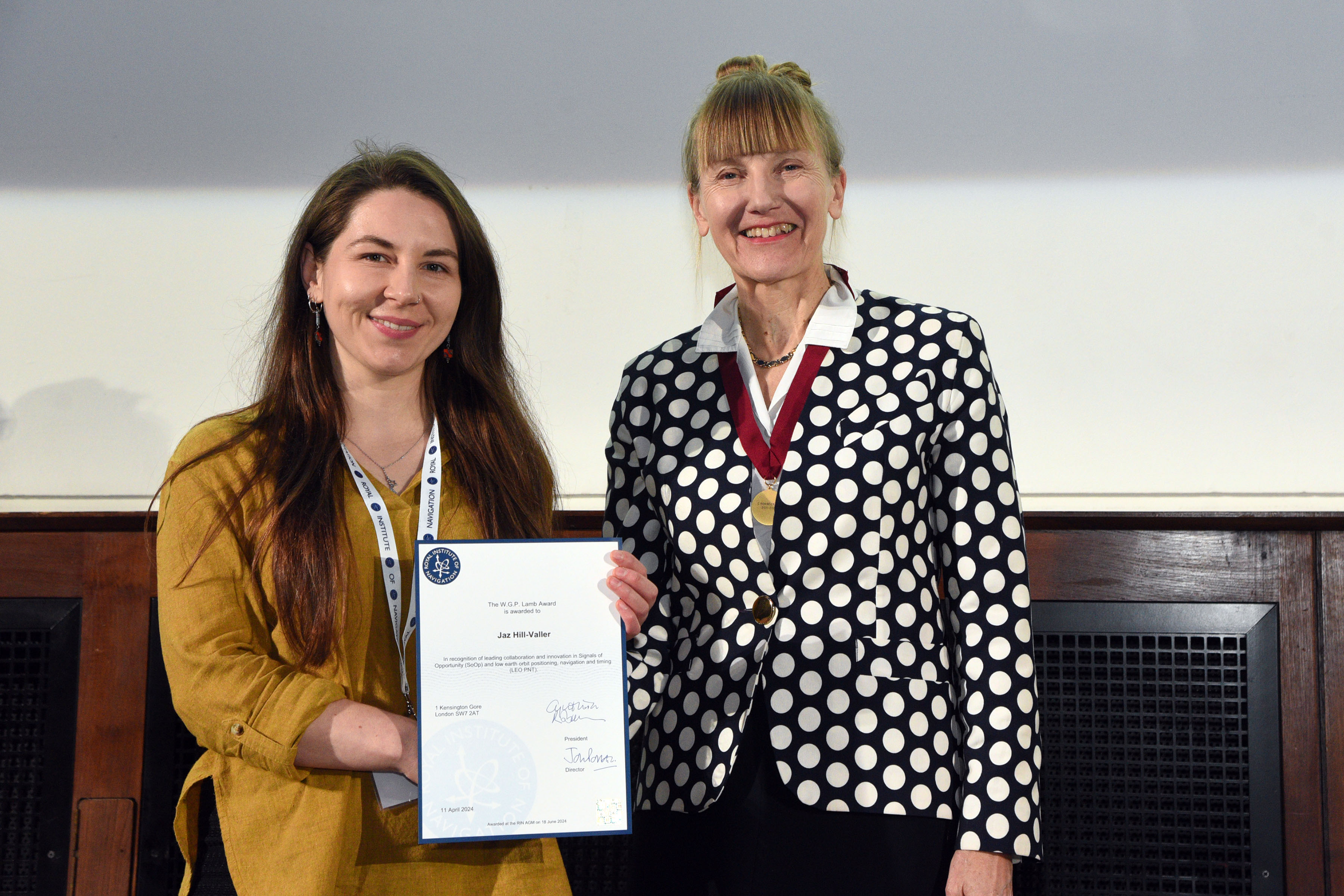
The W.G.P. Lamb Award acknowledges a contribution to a more navigable world by a younger person. This year the worthy winner was Jaz Hill-Valler, in recognition of leading collaboration and innovation in Signals of Opportunity (SoOp) and low earth orbit positioning, navigation and timing (LEO PNT).
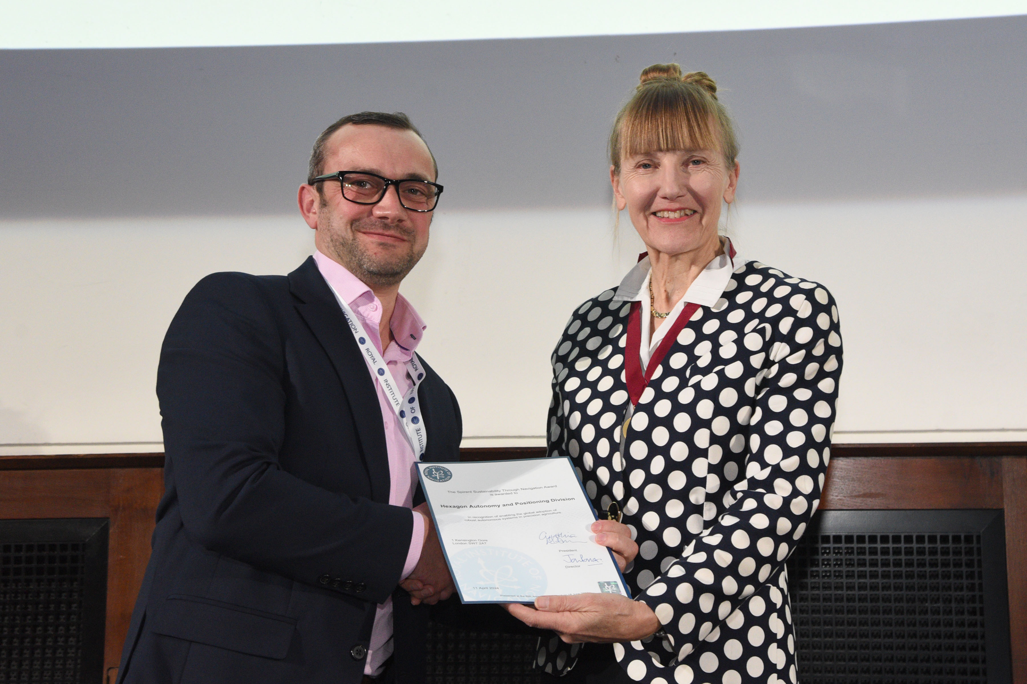
The Spirent Sustainability Through Navigation Award for the application of positioning, navigation and timing towards a more sustainable future was awarded to Hexagon Autonomy and Positioning Division in recognition of enabling the global adoption of robust autonomous systems in precision agriculture.
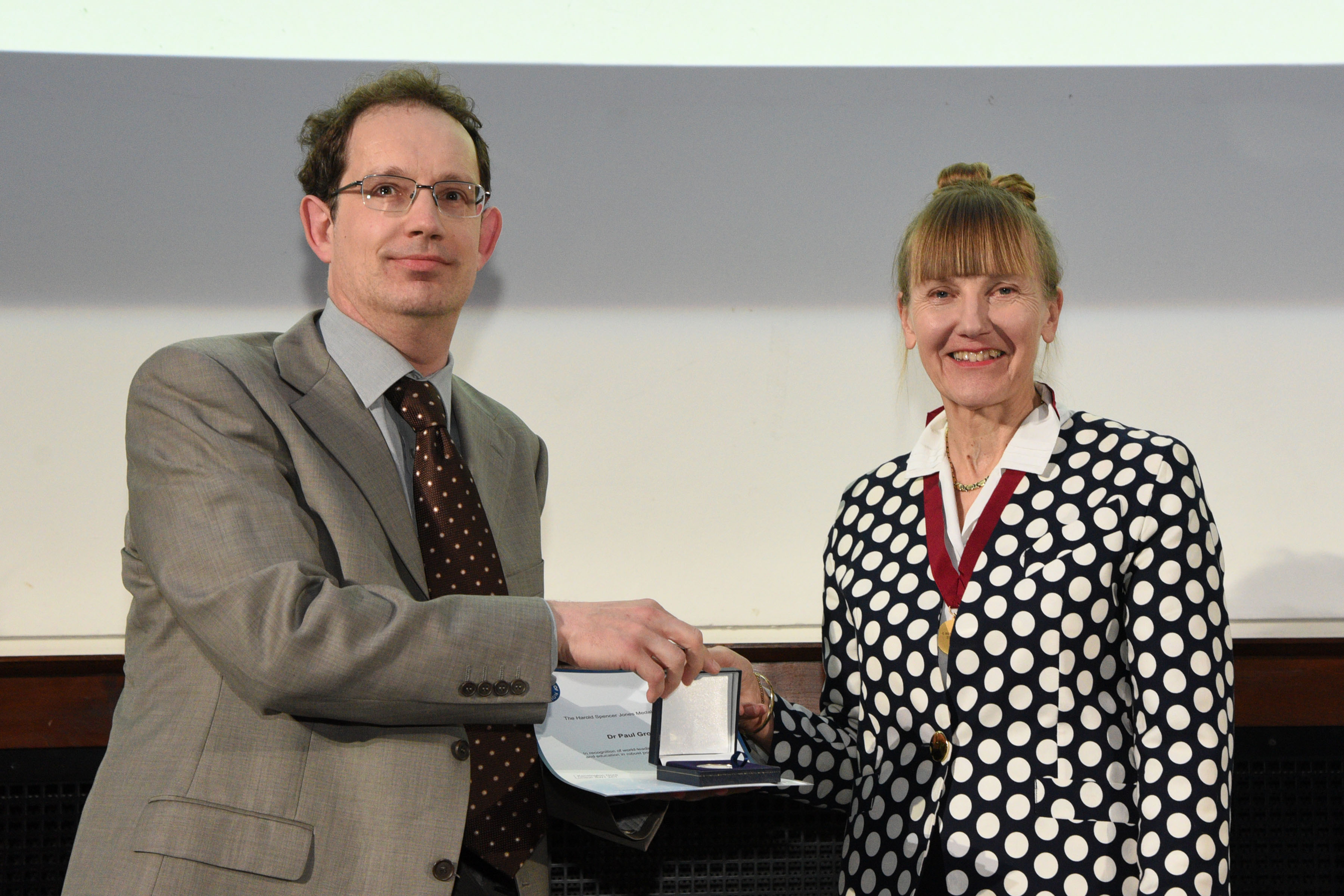
The final award of the day was the Harold Spencer-Jones Gold Medal, in recognition of an outstanding contribution to navigation. This is the highest accolade awarded by the RIN. The 2024 winner of the Harold Spencer-Jones Medal was Dr Paul Groves, in recognition of world-leading pioneering research and education in robust positioning and navigation.
 |
|
|
| W.G.P. Lamb Award winner, Jaz Hill-Valler |
|
|
 |
|
|
| Spirent Sustainability Through Navigation Award winner, Hexagon Autonomy and Positioning Division |
|
|
 |
|
|
| Harold Spencer-Jones Gold Medal winner, Dr Paul Groves |
|
|
Editor’s note:
About the Royal Institute of Navigation:
The Royal Institute of Navigation is a learned society and a professional body for navigation. The RIN's activities cover the full breadth of navigation and precise timing, spanning land, sea, air and space and includes animal navigation, human cognition, navigable cities and buildings and all domains of the practice of navigation.
Contact information:
Dr Clare Stead
comms@rin.org.uk
Released 20 June 2024
Tags:
PNT
RIN Awards
RIN Membership
RIN news
Sustainability
Permalink
| Comments (0)
|
|
|
Posted By Clare Stead,
19 June 2024
|
Professor Washington Yotto Ochieng elected President of the Royal Institute of Navigation (RIN)
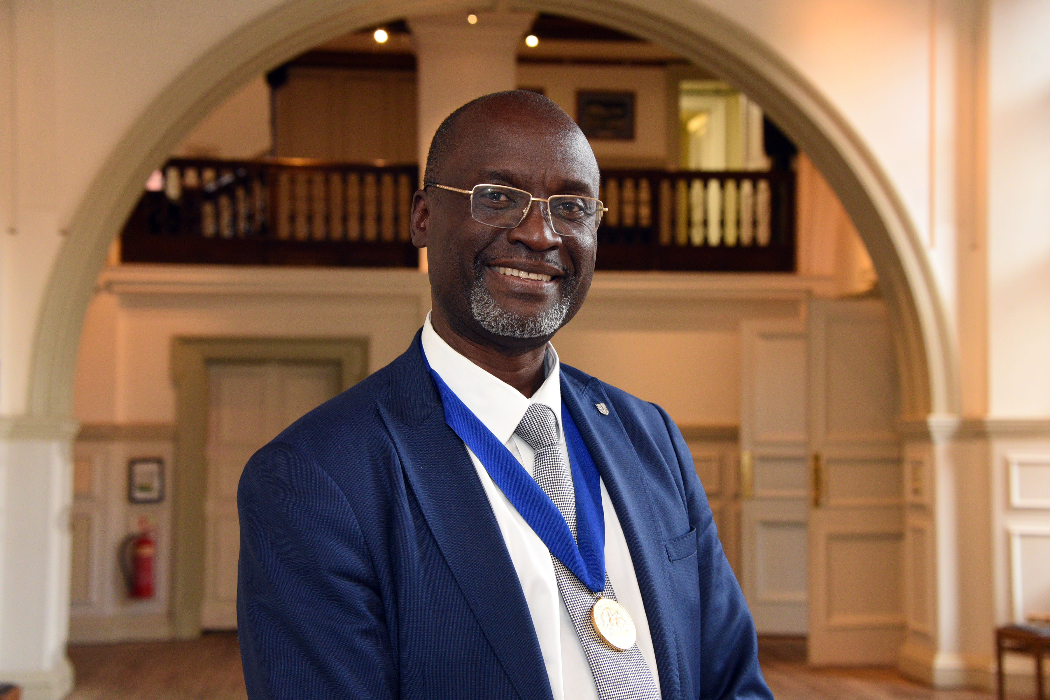
Professor Washington Yotto Ochieng, CBE, EBS, CEng, FREng, FRIN, FICE, FCIHT, FInstCES, was elected President at the RIN's Annual General Meeting (AGM) on 18 June 2024. Professor Ochieng is a serving Trustee and Member of both the Council and Technical Committee of the RIN.
Having joined the RIN in the 1990s and witness it grow from strength to strength thanks to the efforts of so many including the Executive/Secretariat, Council members and Presidents and the wider membership, Professor Ochieng takes on the mantle of leading the RIN at an exciting time following the release of the UK Government's Policy Framework for greater PNT (positioning, navigation and timing) resilience. The start of the implementation of the Framework has seen the UK lead the world in establishing a unique and dedicated PNT Office within the Department for Science, Innovation and Technology (DSIT).
Professor Ochieng is particularly excited by the RIN’s mission and vision. The latter is to “unite in one body those interested in navigation, and to advance the art, science and practice of navigation and to promote knowledge in navigation and its associated sciences, including positioning, timing, tracking and conduct of a journey, whether on, in, over or under land, sea, air or space”.
This is translated into the vision “to be an inclusive group of diverse disciplines and people working together for a more navigable world".
“I very much look forward to working with the Trustees, Council, wider membership, and partners in industry, government, non-governmental organisations and the wider public to promote the vast contributions of PNT and related areas including Geospatial Science and Geomatic Engineering, to the world and beyond, capitalising on our established track record in facilitating research, education, innovation and practice”.
“I am particularly keen to ensure that the RIN plays its role in addressing the challenges of our time (encapsulated within the United Nation’s Sustainable Development Goals) across geography and time, underpinned by a culture of equality, diversity, inclusion, respect, excellence, collaboration, innovation and integrity”.
Professor Ochieng affirms that his Presidency will be anchored on developing talent, capacity building, generating resources, and sustained significant societal impact addressing local, regional and global challenges. Professor Ochieng will challenge each Member of the RIN to identify at least one aspect of the RIN’s work that they will champion in the coming 2 years, taking ownership and demonstrably delivering.
Professor Ochieng is the Head of the Department of Civil and Environmental Engineering, Chair in Positioning and Navigation Systems and Director of the Institute for Security Science and Technology at Imperial College London. He is a Trustee of the Science Museum Group (SMG), Chair of the Science Museum Advisory Board (SMAB), Member of NPL’s Science and Technology Council (STAC) and Scientific Advisor at the DfT and FCDO. He Chairs the Africa Engineers Steering Committee at the Royal Academy of Engineering.
His achievements are highly recognised globally including in his native Kenya as well as in the UK.
In 2022, Professor Ochieng received the honour of Elder of the Order of the Burning Spear (EBS) from Kenyan President Dr William Ruto for his contributions to Kenya and the world. One of the country’s highest national decorations, the EBS is awarded by the President to public dignitaries, exemplary members of the public service, and other professionals who have provided distinguished service.
In June 2024, His Majesty King Charles III of the United Kingdom bestowed upon Professor Ochieng the National Honour of ‘Commander of the Order of the British Empire (CBE)’ for services to Global Positioning and Navigation Systems. A pioneer of Europe’s satellite-based global positioning and navigation systems, Professor Ochieng’s research covers positioning, navigation and timing (PNT) system design and application on water, land, air and space. His research portfolio also includes infrastructure security and resilience, and user-centric mobility. As well as his research, he also advises the UK government on related policy.
Editor’s note:
About the Royal Institute of Navigation:
The Royal Institute of Navigation is a learned society and a professional body for navigation. The RIN's activities cover the full breadth of navigation and precise timing, spanning land, sea, air and space and includes animal navigation, human cognition, navigable cities and buildings and all domains of the practice of navigation.
Contact information:
Dr Clare Stead
comms@rin.org.uk
Released 19 June 2024
Tags:
PNT
Professor Washington Ochieng
RIN Membership
RIN News
RIN President
UN Sustainable Development Goals
Permalink
| Comments (0)
|
|
|
Posted By Guy Buesnel,
19 March 2024
|
The rise of Satellite Based Positioning and Timing
Over the past twenty years, satellite navigation systems have been providing the world with accurate positioning and timing data. The proliferation of devices that use the information from free of direct charge systems, such as GPS and Galileo has been astonishing – in those two decades, we have got to a point where there are said to be more GNSS receivers on the planet than human beings.
Accuracy and Convenience of GNSS
The very high accuracy of GNSS combined with the amazingly low cost of devices that can receive the signals has resulted in the use of PNT data becoming ubiquitous in many application areas where precise positioning or timing data are required. Some of those application areas are in use cases where safety or security are important considerations in addition to the convenience of a low-cost commercial solution.
Critical dependencies emerge
This has led to a growing and high dependence on Space based PNT data that is often not fully understood by the owners, operators and users of the dependent systems and services. This is particularly true of timing data provided by GNSS, where often the use of satellite derived timing data in dependent systems is not even known about, let alone understood. The concern of many of these users remains accuracy and precision (i.e., repeatable accuracy), without regard to the other important PNT metrics of availability, integrity, and coverage. This can and has led to unusual and sometimes alarming consequences when GNSS services have been disrupted. The belief that by simply increasing the number of constellations and satellites this problem can be mitigated has led to significant investments in space-based PNT, while resilient ground-based PNT solutions have been ignored or, even worse, decommissioned.
John Pottle, Director of the Royal Institute of Navigation (RIN) maintains that “used naïvely or in an “unprotected” way, there are risks to accuracy and trust of the information that comes from satellite navigation systems. Alongside the growing dependencies on PNT information, it can be argued that there is an uncomfortable over-reliance in many critical areas.”
RIN White paper identifies no standard set of test cases or approaches to assessing resilience
In 2023 the RIN published a White Paper looking at existing standards for resilient PNT. Titled “Recommendations to Promote the Adoption of Resilient Position, Navigation and Timing in the UK - With Growing Capabilities Come Growing Threats” it concluded that there is no current standard (or set of standards) that identifies the performance requirements needed to ensure resilient PNT to satisfy the needs of all UK Critical National Infrastructure (CNI) stakeholders.
This finding is significant as it is not straightforward to assess the resilience of PNT systems - there is no standard set of test cases or test approaches; and that the concept of a simple “resilience score”, while compelling in theory, can be difficult to achieve in practice at application level, due to the divergence of specific requirements between stakeholder types. However, there are obviously some general principles and guidelines that will have general applicability.
RIN to establish a “Best Practices” Working Group
To help address this pressing need to improve guidance on Resilient PNT in the UK, the RIN intend to set up a Working Group to address the issues and work on developing a set of effective guidance and best practices, that can be used by regulators, operators, owners and users in critical application areas to improve the resilience of their systems and equipment.
The co-authors of the white paper, Mitch Narins and Ramsey Farragher, have this to say on the need for general principles and guidelines that can improve PNT Resilience.
Ramsey Farragher said “Aside from the main actions out of the study, there were two really interesting findings for me from the stakeholder discussions and other background research for the paper. One was the realisation that people in different sectors and parts of the PNT value chain can mean quite different things when they use terms like resilient, robust and assured. Common language across the supply chain and among end users is critical and we will be able to help to establish that. The second realisation was that there will be so much benefit derived from a relatively simple and succinct set of best practice guidelines for each CNI that it will be a crucial “quick win” in advance of any major future undertaking involving legislation and standardisation.”
Mitch Narins highlighted that there is no current standard (or set of standards) that identifies the performance requirements needed to ensure resilient PNT to satisfy the needs of all UK Critical National Infrastructure (CNI) stakeholders (i.e., services providers, users, and use cases). He also points out that over the past two decades many manufacturers and users throughout the world have migrated to using PNT services derived from GNSS without needing to determine their PNT requirements or having a thorough understanding of the impact that loss or degradation of the service would have to them. Whilst creating a single universal standard to cover all sectors and use cases would be a huge and lengthy undertaking, the idea of the RIN working group is to develop a set of recommended best practices which will inform, influence, and motivate users to adopt resilient PNT services and solutions.
Andy Proctor, Chair of the RIN PNT Advisory Group said, “This key activity will take the initial steps forward to improve the PNT System resilience of our critical infrastructure. Forming the team and setting the short- and medium-term objectives and outputs will be crucial to ensuring adoption and success of the principles and practices identified.”
To learn more about the Royal Institute of Navigation's UK PNT Advisory Group or to sign up to its non-member mailing list, please click here.
Tags:
pnt
pnt advisory group
pnt best practice
pnt guidance
resilient pnt
ukpntag
Permalink
| Comments (0)
|
|
|
Posted By Administration,
13 March 2024
|
Mapping the UK's space workforce: 2024 Space Census launched on 12 March 2024
Launched yesterday, the 2024 Space Census aims to provide new data on the UK space workforce and the challenges and opportunities facing the sector.
The national survey of space professionals is conducted by the Space Skills Alliance and collects information about who works in the sector, how they got here, and what their experiences have been.
The results will be used to inform national space policy and sector strategy, and to improve what it’s like to work in the sector, tackle discrimination, and make the sector more attractive to new recruits.
The Space Census first ran in 2020, and its findings have been quoted in Parliament by the Science Minister, in reports by the Science and Technology Commons Select Committee and the OECD, and by many individuals and space organisations in the UK and abroad.
Four reports provided the first comprehensive statistics on demographics, pay, the experiences of women, and how and why people join the sector. Key findings included:
- Foreign nationals make up just under a fifth of the space workforce
- Space pay is competitive with other engineering sectors but not with the tech sector
- 41% of women in the space sector have experienced discrimination
- Most people join the space sector at the start of their career, three quarters have joined by age 35
The 2024 Space Census is supported by more than 30 space organisations including the UK Space Agency, the Department for Science, Innovation and Technology, and UKspace. It will build on the 2020 edition to give a more detailed picture of trends within the sector. New questions will collect information on professional development, career breaks, and retention. The first results for 2024 are expected to be released later in the year.
If you work in the UK space sector, take part in the 2024 Space Census at census.spaceskills.org. The Census closes Friday 3rd May 2024.

Tags:
pnt
resilient pnt
space census
space skills
Permalink
| Comments (0)
|
|