 
|
Posted By John Hasselgren.,
18 October 2021
|
This annual meeting was held on line via Cisco Webex on 7th. October. Hopefully, this report will give a flavour of meeting.
Information was given on the progress of the new vessel to replace THV Patricia, which will be retired. Approval for the new vessel has been given by the DfT and the Cabinet Office, with financial assurance provided by the Treasury. The new design is to be for a vessel capable of undertaking the core tasks of Trinity House such as buoy maintenance, lighthouse support and survey work, but with greater emphasis placed on heavy weather performance. This last is required due to a Risk Response review which, having considered modern traffic analysis, requires six hour and twelve hour responses in certain critical areas, most of which fall within the Trinity House area of responsibility. Propulsion and on board services will use a hybrid system to reduce fuel consumption, with stored batteries supplying the needs during periods of low power use. Tender documents have now been released to yards that were able to meet pre-selection criteria.
Support vessel operations for the three TH vessels Alert, Galatea and Patricia, along with the chartered MV Mair were shown. These indicated that Galatea and Patricia had carried out the majority of the annual buoy servicing and that Alert and Mair had completed most of the hydrographic surveys undertaken. The Covid-19 pandemic had required the crews of each vessel to have been tested prior to embarkation and then to operate in their own bubbles. More recent easing of restrictions had allowed Alert’s main crane to be replaced, providing a more reliable unit requiring reduced maintenance.
The modernization of Lundy North Lighthouse has been completed, allowing an increase in the nominal range to 18NM. Projects to modernize the lighthouses at St. Tudwals, Lynmouth Foreland and St. Catherine’s are progressing. At St. Tudwals the solar panels are being moved from ground level onto the tower, all electronics are being renewed and the current roof mounted emergency lantern will be moved into the tower. Lynmouth Foreland rotating optic is being changed to a modern LED unit which will only be displayed at night, thus reducing the power needed. St. Catherine’s electrical system is being upgraded and the light reduced to a nominal 18NM, made possible by modern navigation systems used in vessels and the fact that passing traffic tends to be further offshore. The red sector along the West coast of the Isle of Wight is being maintained as it is extremely important to vessels navigating to and from the Needles Channel.
Discussions revealed a request for the installation of a 5G mast on the St. Catherine’s site to provide coverage over the Solent. This could provide suitable contact with future autonomous vessels and also coverage of sailing events such as the Round the Island Race to broadcasters.
Modernization of Flamborough Head and Farne Lighthouses is being planned. The lantern range at Flamborough Head will be reduced to 18 NM and the Hazard Warning Signal will become the standard 1 blast every 30 seconds. The red sector at Farne lighthouse will be increased from 7 to 8NM, with a more efficient light source and upgraded electronics.
The decommissioning of Royal Sovereign Lighthouse continues and has passed government approval, with the tendering process under way. Tenderers will be free to propose their own method of removal and allowed to spread this over three summers. The lighthouse was built in 1969 with an expected life of 50 years and is now deteriorating beyond economic repair. Altered traffic patterns, coupled with improvements at Beachy Head Lighthouse plus an offshore buoy, have made it less relevant.
Both Channel Lightvessel and Sunk Centre Lightvessel have been replaced by buoys. Traffic patterns over 28 days were shown, both before and after the removal of the lightvessels, and these indicated almost exactly similar patterns. The new Channel Light Buoy has meteorological equipment installed on it, designed with the Met Office, and will continue to provide data to feed into met forecasting models as well as offering real time information to local users.
Trinity House now have six lightvessels and one lightfloat on station, mostly marking significant dangers. All are getting old and need more frequent docking for maintenance. No decision has yet been made about their replacement, but any new design will no longer have to include crew space.
A major project is under way to replace the current monitoring method at lighthouses, lightvessels and significant buoys. This is currently achieved using a Vodafone VHF system called Paknet which they intend to close down in the near future. The stations will then be monitored using a mix of 4G and Iridium satellite communications.
As previously announced the DGPS system will cease at the end of March 2022. The MCA has issued MIN665 on this.
Moving on to Offshore Renewables we learned that 337 AtoNs at 35 sites were inspected and 29 were found to be defective. This is a marked improvement on the previous year, helped by increasing assistance and positive engagement received from the Crown Estates. It currently seems likely that the tidal power development off the Isle of Wight near St. Catherine’s will be started next year. Trinity House is waiting to see if consent will be given by the Secretary of State for BEIS (Business, Energy and Industrial Strategy – yes, I had to look it up!) for projects at North Vanguard, Norfolk Boreas, East Anglia One North and East Anglia Two. Also waiting on the decision by the Welsh Assembly on power developments at Morlais off Anglesea.
Construction is due to start on windfarms on the Dogger Bank, with Trinity House fully engaged with the lighting and marking for these sites. They are also engaged with the developers on numerous projects, including Floating Offshore Windfarm developments in the Celtic Sea, two large windfarms between the Mersey and the Isle of Man, and all the planned extensions to existing windfarms.
The BEIS (see above) have commenced a review of “National Policy Statements on Energy”, which is due to run until 29th. November. Trinity House are engaged in the process and recommend others with interests in Shipping and navigation to engage in this at:
(https://beisgovuk.citizenspace.com/energy-strategy-networks-markets/energy-nps/)
Although no member of GRAD was present, documentation provided an update of their work. This includes working with Emu Analytics Ltd. to develop a means of predicting ship movements around windfarms using AI – Continuing work on the BinoNav® method of transferring bearings to an electronic chart, which the Nautical Institute is keen to support – Improving the efficiency of LED lights with trials of a 24 sided lamp, fitted with 72 LEDs, for installation in traditional optics – A study of how Machine Vision could be used to enhance electronic navigation at sea using a camera for flash detection in poor visibility. This last one must please Andy Norris.
John Hasselgren.
Tags:
Leisure Vessels
Maritime
Sailing
Trinity House
Permalink
| Comments (0)
|
 
|
Posted By Graham Purchase,
11 August 2021
|

BMFA Windsock
This July, RIN GANG supported the annual IMechE Universities UAS Challenge Fly-Off, which was held at the British Model Flying Association HQ in rural Leicestershire.

GP holding a Tracker
Graham Purchase took the GANG TopNav GPS trackers along, for use inside the aircraft. The trackers have to be charged and initialised before use.

GPS Trackers on charge
The tracker flight data was used to give scores for Routing via the specified waypoints, Average Speed and Glide Performance. Analysis tools include Google Earth™.

Surrey flight data on Google Earth
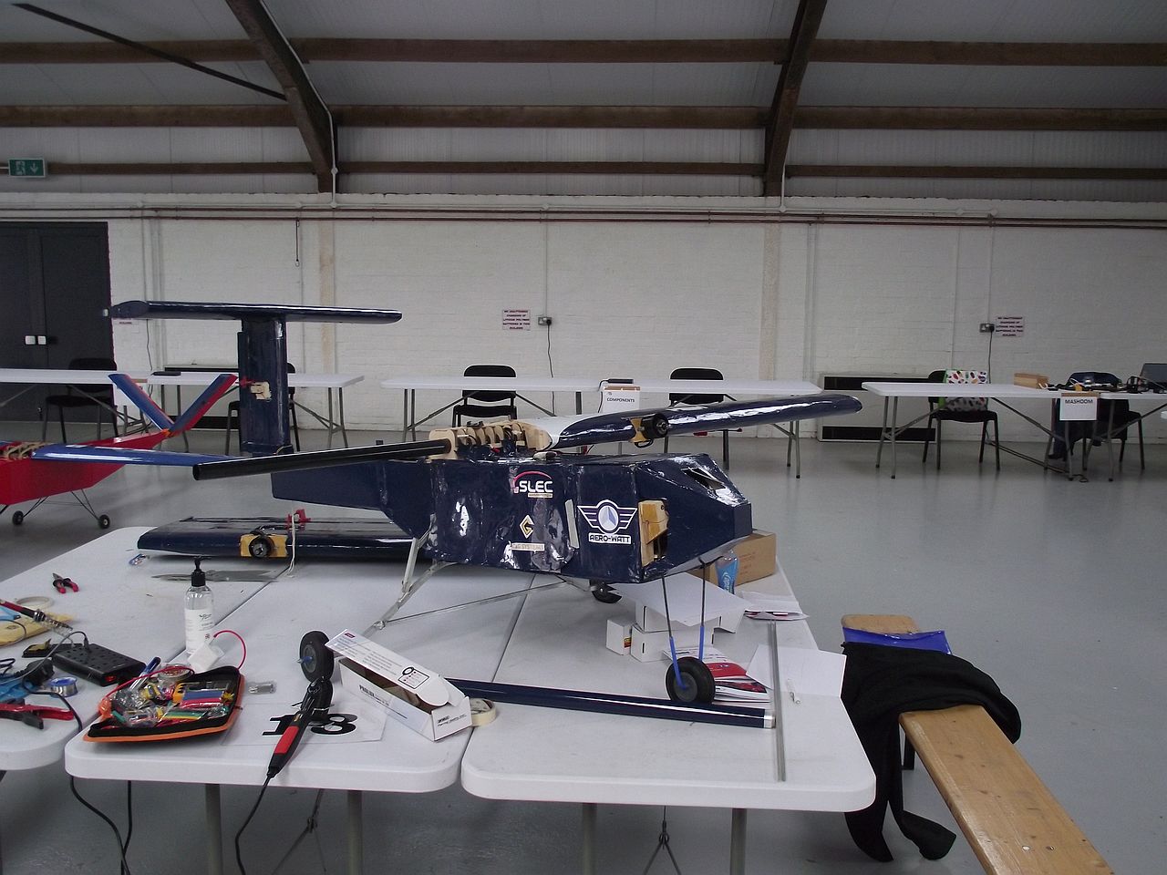
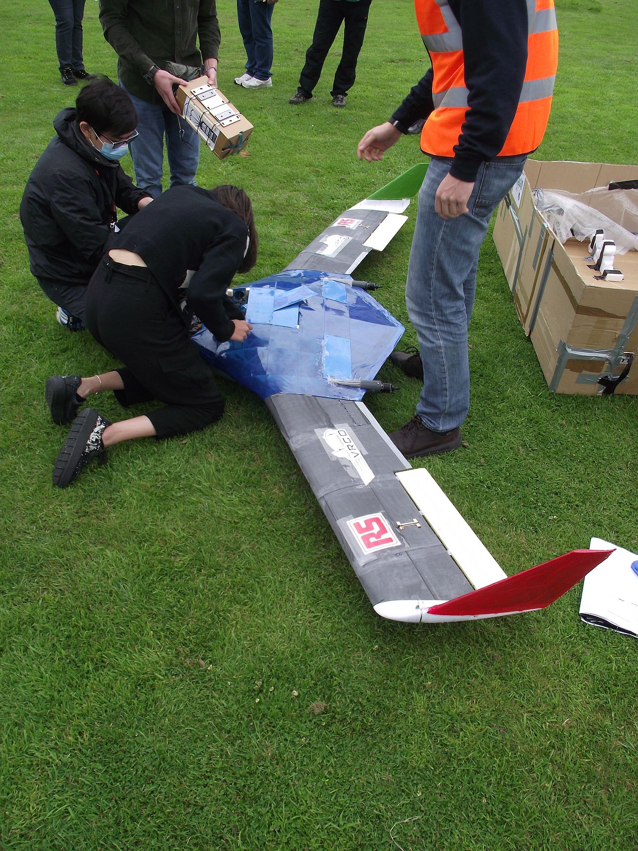
4 of the 6 teams arrived with a partially built UAS, so construction work soon got underway.

Construction Underway
Teams were allocated a ‘pit lane’ in the hangar. This drone made it to the flight line, but when launched, it headed for the nearest bush!

Drone in the Hangar
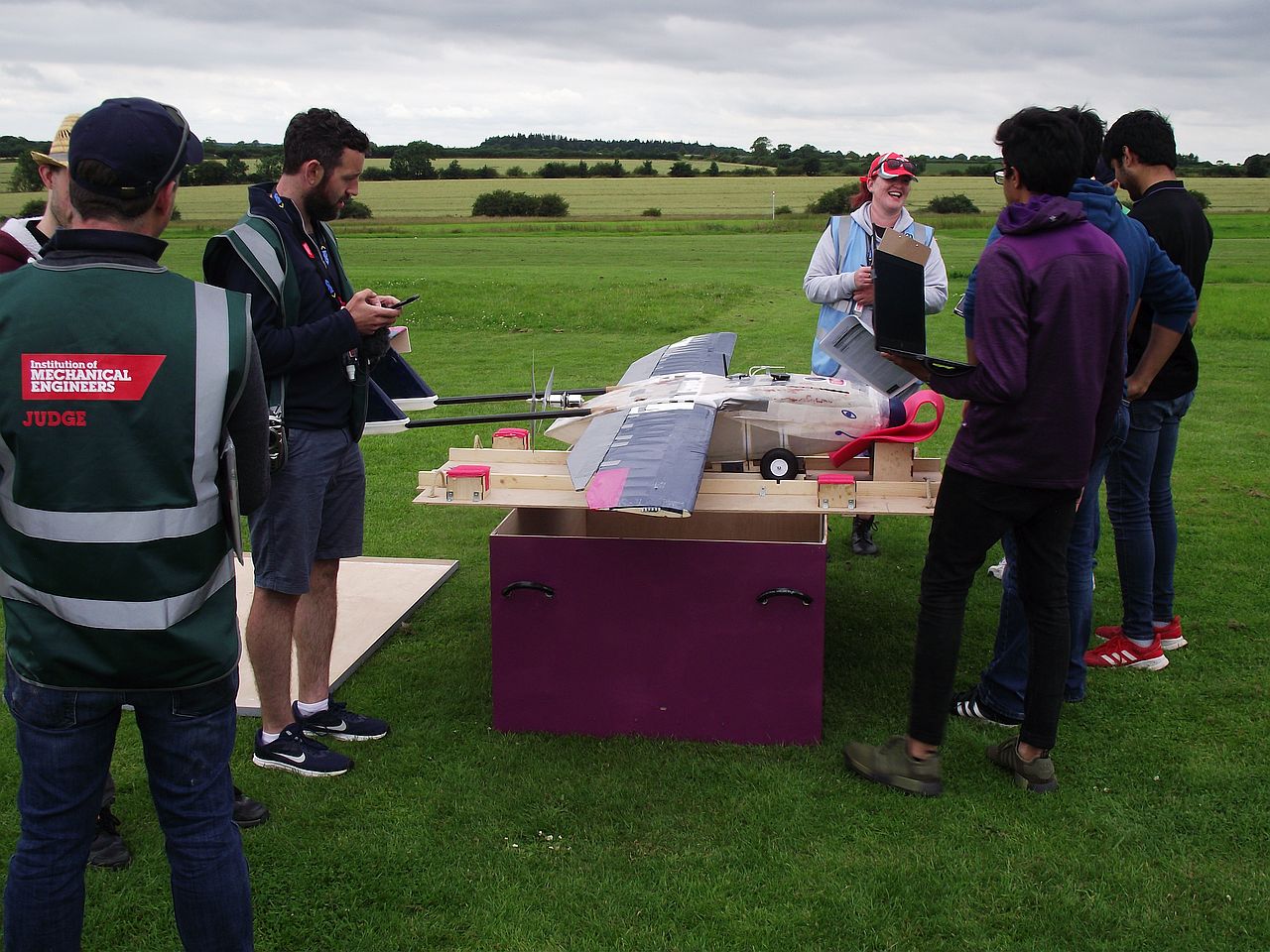
The transit cases are an innovation this year, which tries to emulate a real-life scenario of transporting a UAS (drone) to a remote location. The UAS would then be deployed and to locate the drop-zone and deliver some humanitarian supplies. The payload weight was also increased this time, and teams responded with larger, mostly fixed-wing designs.

Surrey UAS on Transit Case
At around 1300 on the first day, there was news of a possible flight, so everyone rushed out to the flight line.

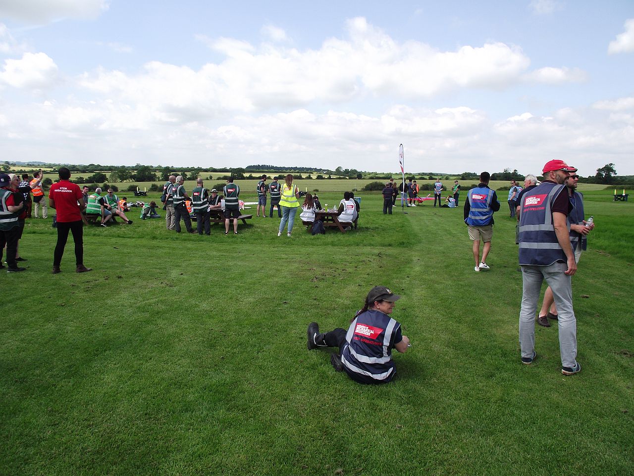
Officials Waiting Expectantly
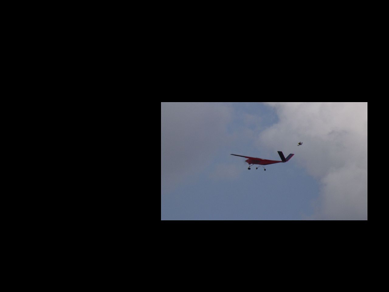
However, it was 4 hours later that the first successful flight of the Surrey UAS actually took place! This proved to be the only successful ‘mission’ although the ‘supplies package’ failed to release.

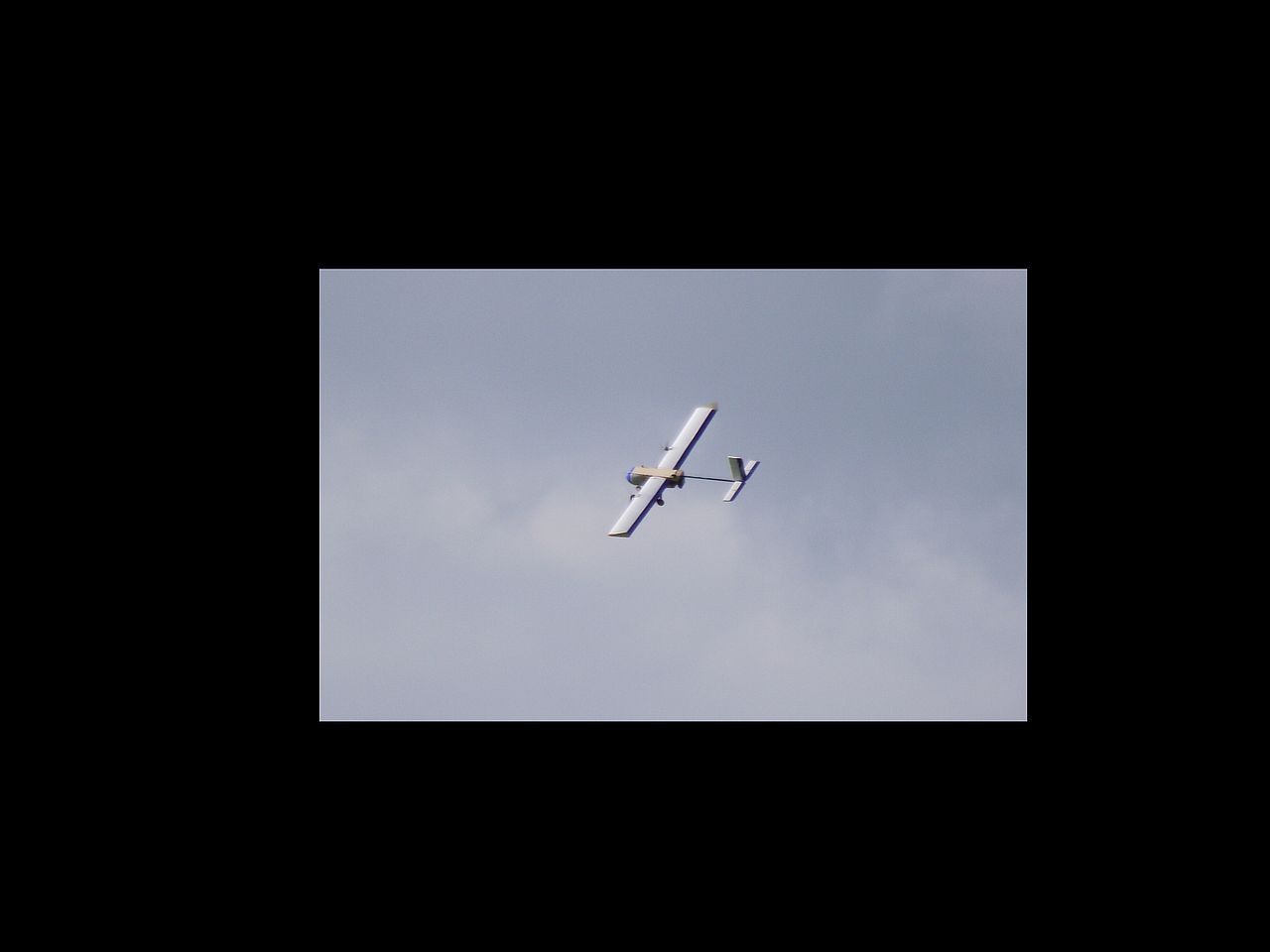
Surrey UAS Airborne (The Winner!)
The Brunel team produced the largest UAS.

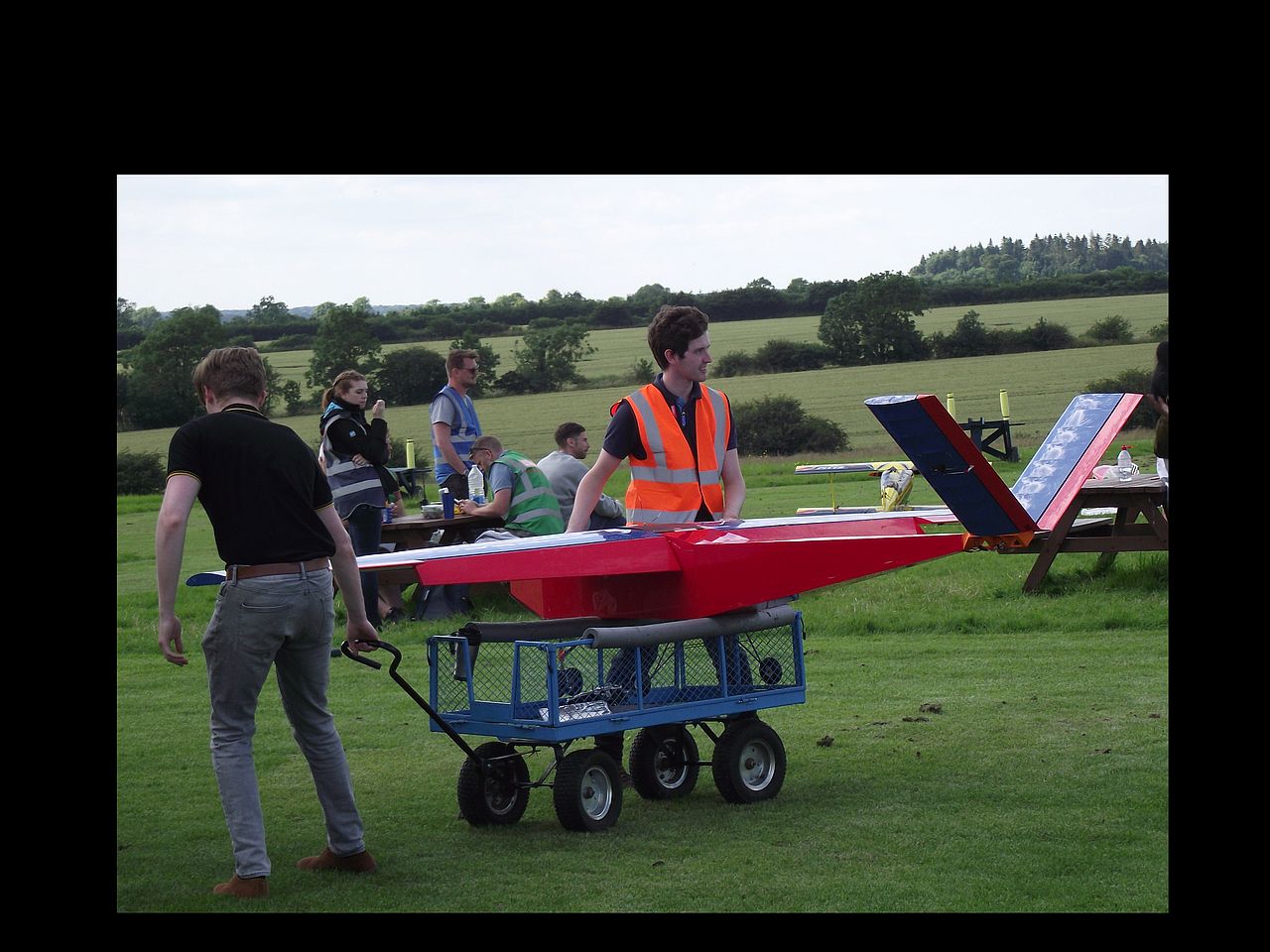
Brunel UAS on Trolley
This UAS had to be flown manually, but it scored points for its Speed and Glide Performance.

Brunel UAS airborne + ‘chase’ quadcopter
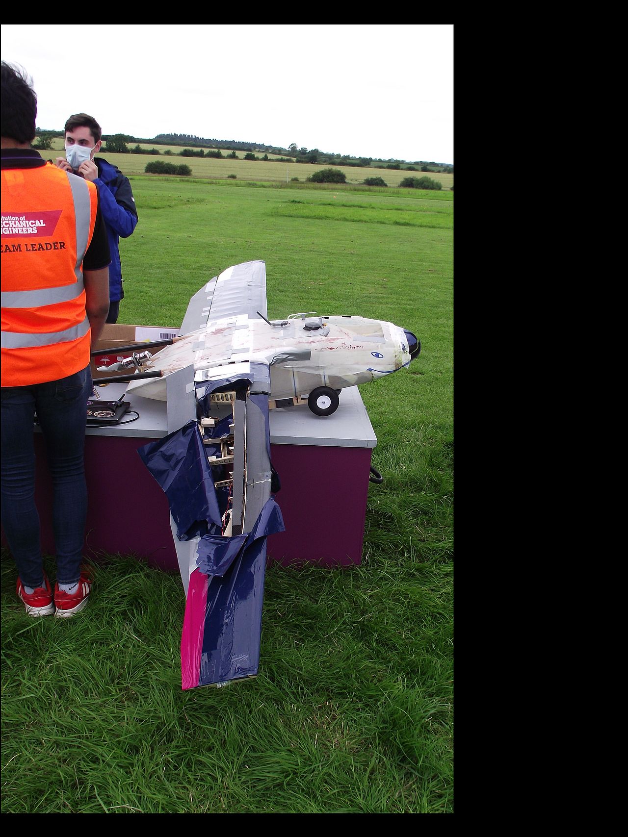
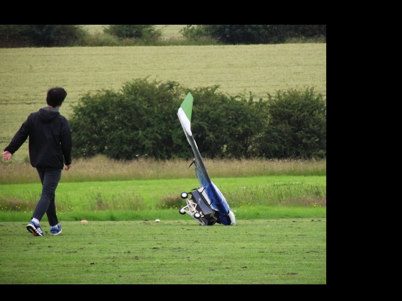
Other teams were less successful: this drone took off steeply, but immediately crashed from about 20 feet. Remarkably, it was repaired overnight, but repeated the performance a second time!

Before the Crash!
This UAS was repaired after an incident, but the wings seem to be at different angles of incidence. The second photo shows the result of a very short flight!

Look at the Wingtips

After the crash!
Another team’s UAS had a trolley undercarriage that failed to release, even after several attempts to take-off!

Failed Launch!
It’s not just a flying competition; there are many prizes available, eg for Design, Innovation, Safety, Business Case etc.

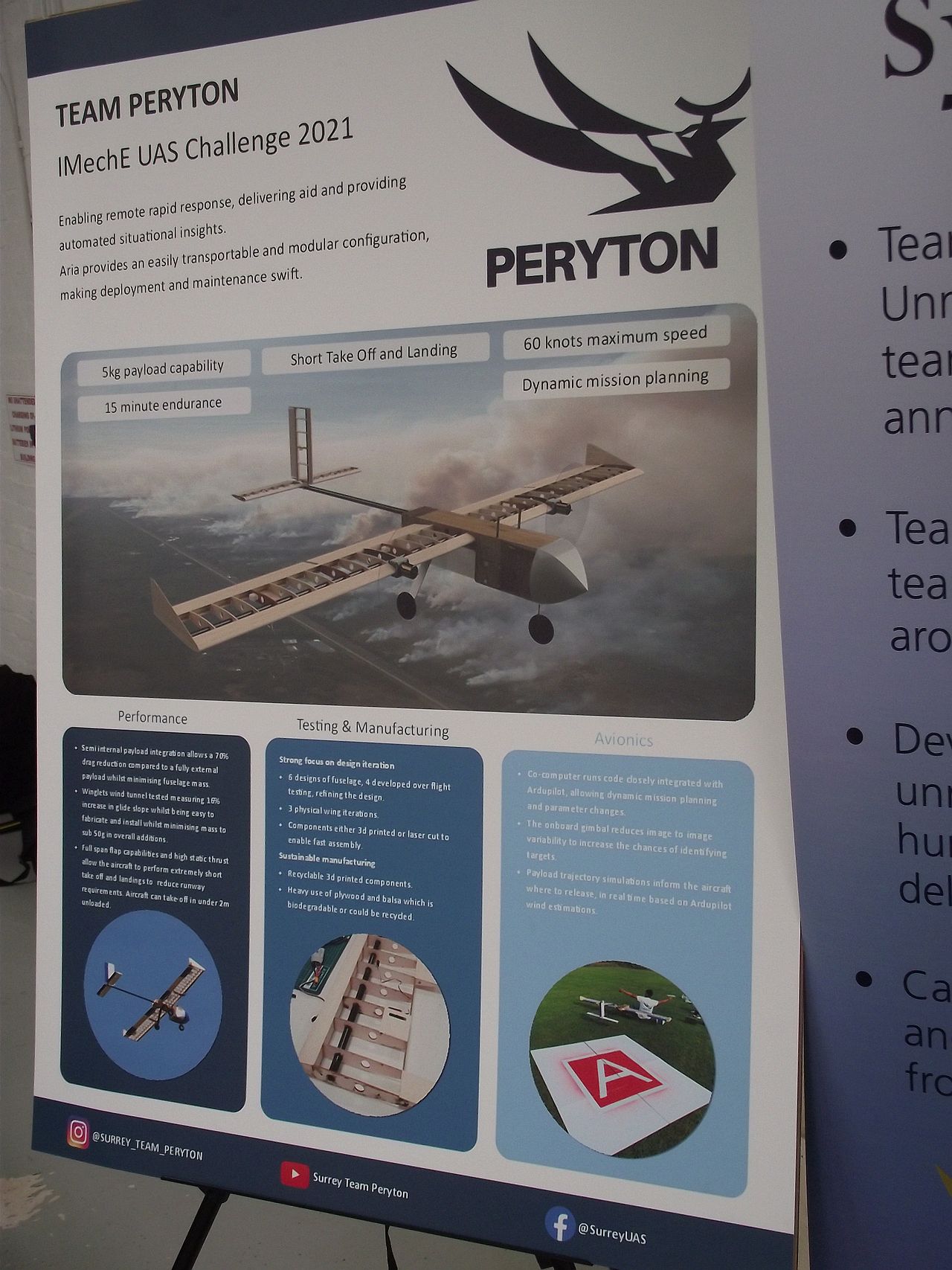
Team Peryton (Surrey University) Poster
Several VIPs from the sponsors and IMechE, plus the Mayor of Melton Mowbray attended the event on the second afternoon.

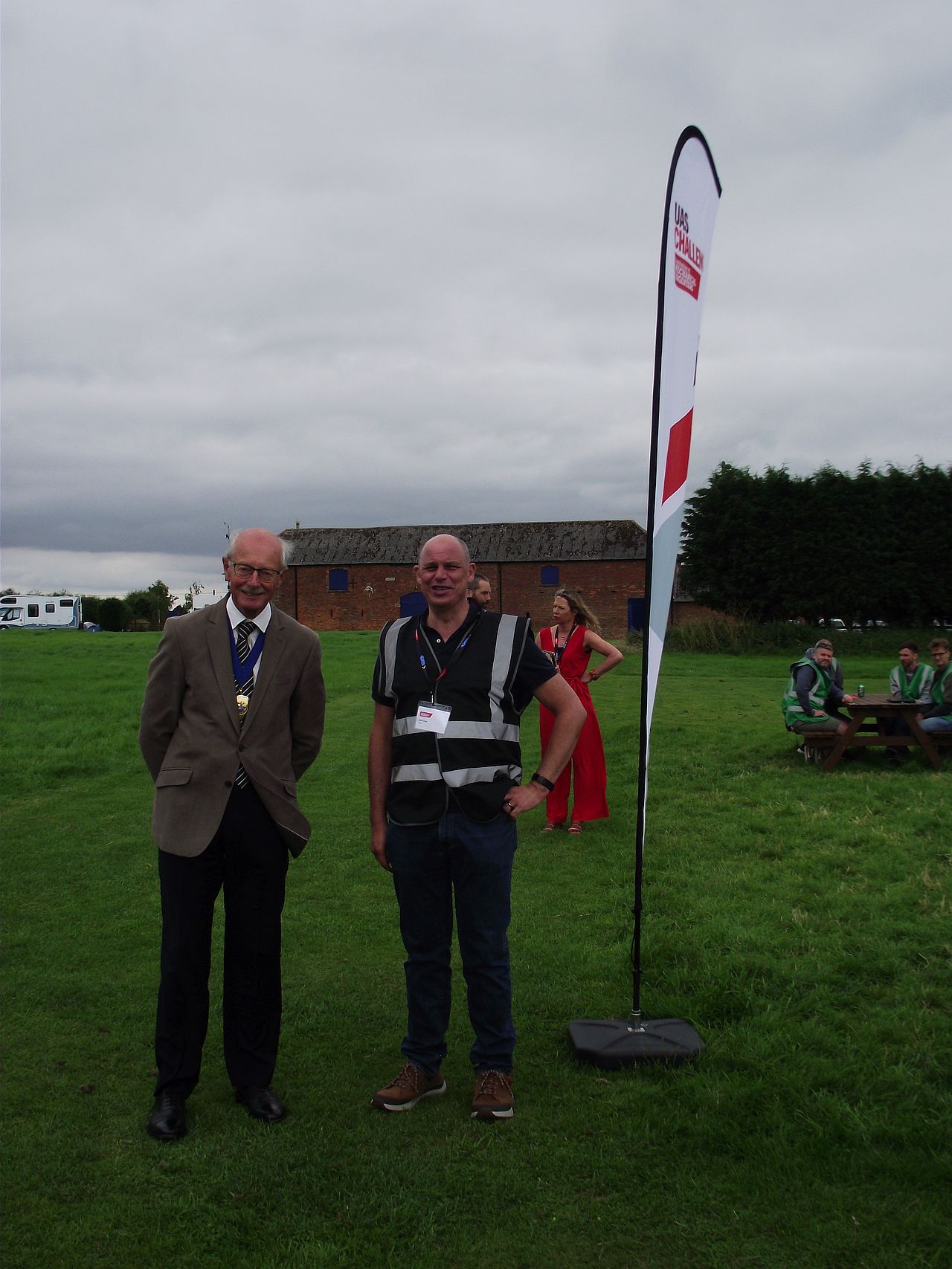
IMechE President & UASC Chairman
The Loughborough team achieved 2nd place, but won most of the trophies, including one presented by the IMechE CEO, Dr Alice Bunn.

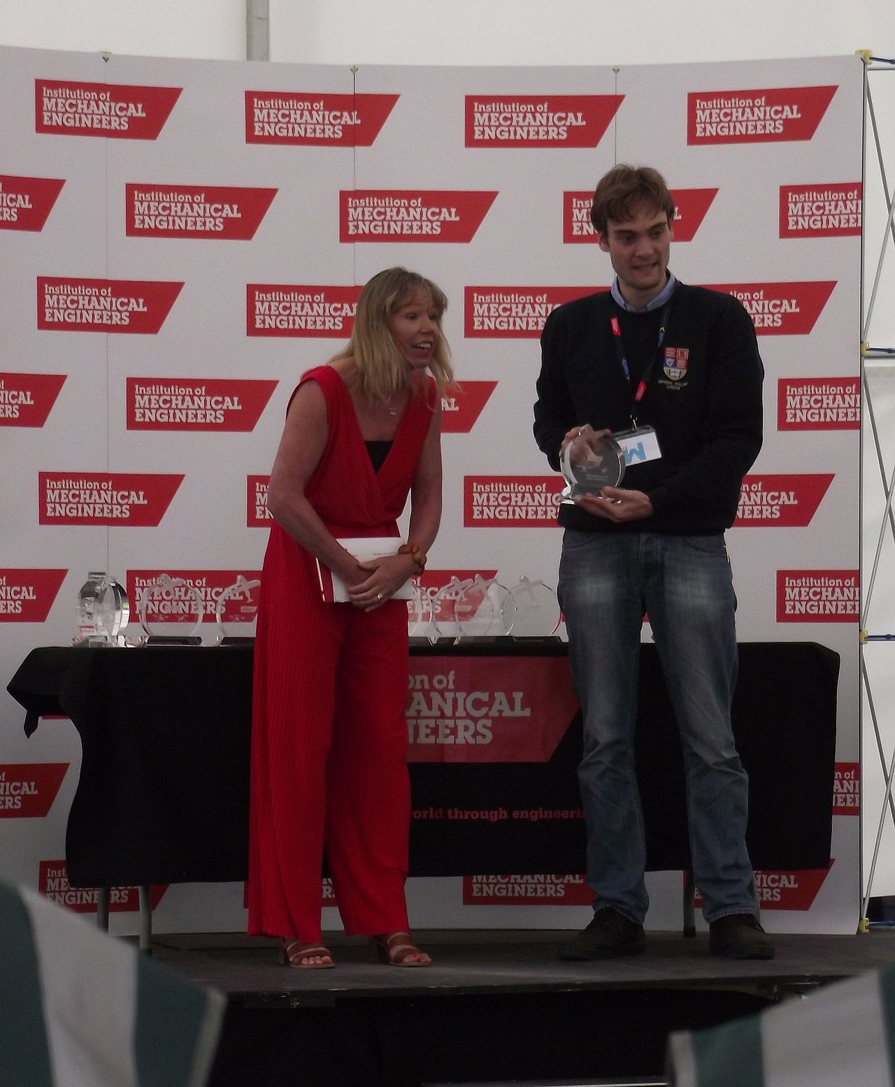
IMechE CEO - presentation to Loughborough team leader
The long-serving chief judge, Lambert Dopping-Hepenstal, also received a presentation from the UASC chairman, AVM Paul Lloyd (Also the RAF’s Chief Engineer).

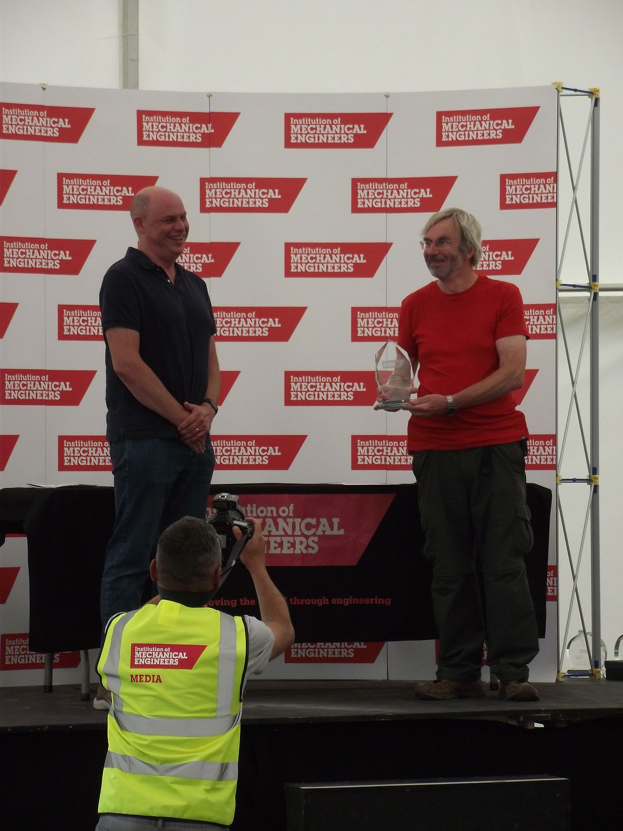
UASC Chairman - presentation to chief judge
Most of the teams that entered this year’s competition could not make it to the live event, so a parallel virtual competition was held, using a flight simulator to evaluate the various UAS designs. The winner of the Virtual Competition is Team Wrise from the Indian University of Petroleum and Energy Studies.

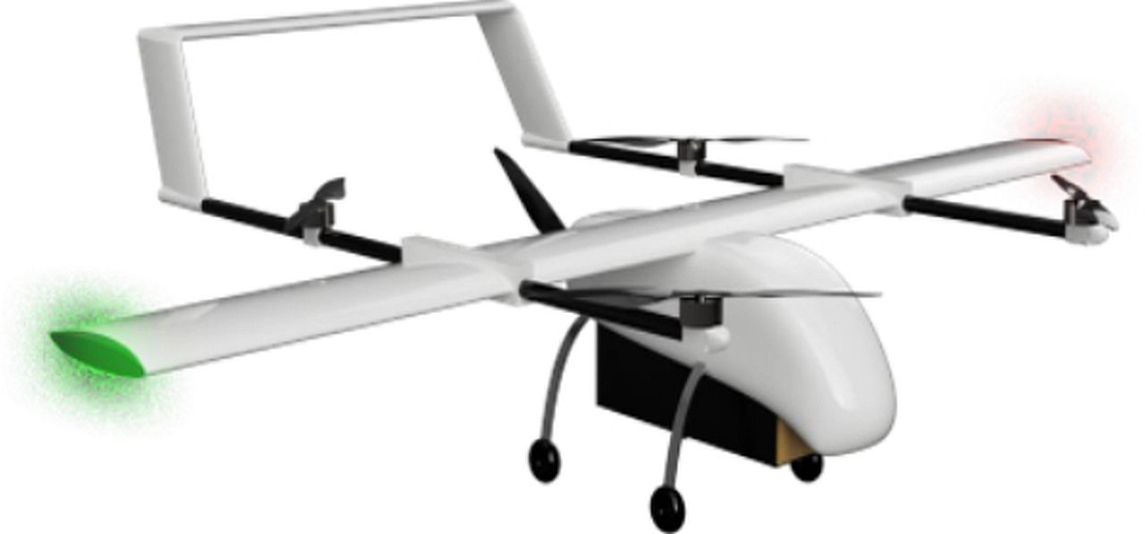
Virtual Winner’s Hybrid Design
The competition will return to Buckminster next year, and a full entry of up to 40 teams is anticipated. Here is the URL for entries to the 2022 UAS Challenge:
https://www.imeche.org/events/challenges/uas-challenge
This post has not been tagged.
Permalink
| Comments (0)
|
 
|
Posted By Kim Fisher,
19 May 2021
|
This was an eight-day meeting of the Committee but limited to 3 hours a day using the KUDO platform so proved very challenging and it was not possible to complete the agenda. The previous Chair. Bradley Groves of Australia, had completed his five-year term and the new Chair elected was Mrs Mayte Medina of the USA. She had previously been Chair of the Subcommittee on Sub-Committee on Human Element, Training and Watchkeeping.
In opening the meeting, the Secretary-General stressed the important contribution made by seafarers and the need for member countries to classify them as key workers, of which only a third of the membership had in fact so far done. The meeting developed a resolution concerning COVID-19 vaccination of seafarers asking members to prioritize their seafarers and exempt seafarers from requiring proof of COVID-19 vaccination as a condition for entry. An Assembly resolution will be developed for the next Assembly meeting.
The substantive issue at the meeting concerned the regulatory scoping exercise for the use of Maritime Autonomous Surface Ships (MASS). Considerable work had been done by an Intersessional Group and a draft report had been prepared which was successfully finalised and will be issued as a Circular. This reviews the mandatory instruments related to maritime safety and security establishing how they would be affected against four degrees of autonomy; ships with automated processes and decision support but with seafarers are on board, remotely controlled ships but with seafarers on board, remotely controlled ships without seafarers on board and fully autonomous ships. It is now considered that the best way forward to address MASS in the IMO regulatory framework would be through the development of a goal-based MASS Code and Member States are invited to submit proposals to the next meeting.
Piracy and armed robbery continues to be a problem with 228 incidents reported in 2020, particularly in the Gulf of Guinea West Africa. A resolution was prepared on recommended action to address piracy and armed robbery in the Gulf of Guinea and an Assembly resolution will be developed on prevention and suppression of piracy, armed robbery against ships and illicit maritime activity in the Gulf of Guinea.
On navigation and communication matters, amendments were agreed to the International Aeronautical and Maritime Search and Rescue (IAMSAR) Manual. The burden of the extra cost of transmitting MSI and SAR related messages over multiple satellite system providers was discussed. Various proposals were considered and the topic will be progressed through a correspondence group established under the coordination of Australia.
New work items were agreed for performance standards and SOLAS amendments to introduce the VHF Data Exchange System (VDES) and for performance standards for a digital navigational data system NAVDAT.
The next meeting has been scheduled for 4 to 8 October and a further meeting is expected in the first half of 2022 but dates have not yet been decided.
Tags:
IMO
International Maritime Organization
Mar
Permalink
| Comments (0)
|
 
|
Posted By Kim Fisher,
27 April 2021
|
The meeting of the sub-committee on Navigation, Communications, Search and Rescue which had been planned for 10 to 19 February 2021was finally conducted online and with a limited agenda. It was chaired by Ringo Lakeman of the Netherlands. This meeting competed his 5 year term as chairman so the vice chair Nigel Clifford of New Zealand will now take over with Alexander Schwarz of Germany as the new vice chair.
The major task of the meeting was to complete the revision of Chapter IV (Radiocommunications) of the International Convention on the Safety of Life at Sea (SOLAS) and associated documents, a task that had been ongoing since 2009. A special meeting of the Communications Working Group had been held in the previous two weeks which had prepared complete texts and which in the event were agreed without comment. The texts now go the Maritime Safety Committee at the meeting MSC 104 in October, the next meeting MSC 103 in May being too close to allow the documents to be prepared. The revised Chapter does not greatly change any requirements with the exception of permitting satellite systems in addition to Inmarsat.
A correspondence group reported on Safety measures for non-SOLAS ships operating in polar waters. It was not possible to complete the work at the meeting so the correspondence group will be re-established. It is now intended that the measures will apply to fishing vessels of 24 metres and above, pleasure yachts of 300 gross tonnage and above not engaged in trade, and cargo ships of 300 gross tonnage and above but below 500 gross tonnage.
A further correspondence group reported on Revision of the Guidelines on places of refuge for ships in need of assistance. Again, it was not possible to complete the work at the meeting and again the correspondence group will be re-established.
A new Iridium SafetyCast service manual had been prepared as a replacement for the existing interim manual. However, it was considered that this was incomplete and should be looked at again at the next meeting. Work continues on the arrangements for coordinators to broadcast navigation and weather information to ships fitted with Iridium terminals and the modifications to the Master Plan module of the web based Global Integrated Shipping Information System (GISIS) to include information on the implementation of the Iridium SafetyCast service.
The Japanese satellite navigation system QZSS was agreed to be recognised as part of the worldwide radionavigation system despite concerns from Korea and China. A correspondence group reported on the development of generic performance standards for shipborne satellite navigation system receiver equipment but there was insufficient time to progress this, which will now be referred back to the correspondence group.
Amendments to the performance standards for Voyage Data Recorders were agreed to refer to the new Emergency Position Indicating Radio Beacon requirements for use with the float free capsule.
A liaison statement was prepared to send to the International Telecommunications Union concerning the problem of interference from mobile phone systems to Inmarsat terminals on ships. A further issue was reported of interference from mobile phone systems to the Inmarsat land earth station at Burum in the Netherlands. If this cannot be managed then there may be a need for Inmarsat to relocate from Burum.
There were no ship routeing proposals to discuss due to the limited agenda which will result in a back log for the next meeting. To help the work a special meeting of the ship routeing group will be held in advance of the next meeting.
No date was set for the next meeting due to continuing uncertainties in planning around the Covid pandemic. The IMO Council will meet in July to discuss the meeting programme. It is hoped that there will be an eight-day meeting in 2022. It is hoped that new agenda items will be included to revise the electronic chart performance standards to include a transition to the new S-101 chart data format, amendments to the Voyage Data Recorder performance standards to include recording of telephone conversations and a revision of the criteria for the provision of mobile satellite communication services (resolution A.1001(25)).
A meeting of the Maritime Safety Committee (MSC 103) is planned for 5 to 14 May 2021 and a further meeting (MSC 104) for 4 to 8 October 2021. A meeting of the ICAO/IMO Joint Working Group is planned for 6 to 10 September 2021. A meeting of the Joint IMO/ITU Experts Group is planned for 1 to 5 November 2021.
Tags:
IMO
International Maritime Organization
maritime
Permalink
| Comments (0)
|
 
|
Posted By Jade Morton,
07 December 2020
Updated: 02 November 2020
|
by Jade Morton, Frank van Diggelen, Bradford Parkinson
After more than five years of hard work by 131 authors from 18 countries, “Position, Navigation, and Timing Technologies in the 21st Century” (“PNT21”) is finally ready to meet the readers. Published by Wiley-IEEE Press, and written by world-renowned experts, PNT21 offers uniquely comprehensive coverage of the latest developments in the field of PNT .
PNT21 is a two-volume set containing 64 chapters organized into six parts. Volume 1 focuses on satellite navigation systems, technologies, and applications. It starts with a historical perspective of GPS and other related PNT development. Vol 1 Part A consists of 12 chapters on fundamentals and latest developments of global and regional satellite navigation systems (GNSS and RNSS), the need for their coexistence and mutual benefits, signal quality monitoring, satellite orbit and time synchronization, and satellite- and ground-based augmentation systems that provide information to improve the accuracy of navigation solutions. Part B contains 13 chapters on recent progress in satellite navigation receiver technologies such as vector processing, assisted and high sensitivity GNSS, precise point positioning (PPP) and real time kinematic (RTK) systems, direct position estimation techniques, and GNSS antennas and array signal processing. Also: the challenges of multipath-rich urban environments, in handling spoofing and interference, and in ensuring PNT integrity. Part C finishes the volume with 8 chapters on satellite navigation for engineering and scientific applications. A review of global geodesy and reference frames set the stage for discussions on the broad field of geodetic sciences, followed by a chapter on GNSS-based time and frequency distribution. Three chapters are dedicated to severe weather, ionospheric effects, and hazardous event monitoring. Finally, comprehensive treatments of GNSS radio occultation and reflectometry are provided.
Volume 2 addresses PNT using alternative signals and sensors and integrated PNT technologies for consumer and commercial applications. An overview chapter provides the motivation and organization of the volume, followed by a chapter on nonlinear estimation methods which are often employed in navigation system modeling and sensor integration. Vol 2 Part D devotes 7 chapters to PNT from various radio signals-of-opportunity transmitted from sources on the ground, from aircraft, or from low Earth orbit (LEO) satellites. In Part E, there are 8 chapters covering a broad range of non-radio frequency sensors operating in passive and active modes to produce navigation solutions, including MEMS inertial sensors, advances in clock technologies, magnetometers, imaging, LiDAR, digital photogrammetry, and signals received from celestial bodies. A tutorial-style chapter on GNSS/INS integration methods is included in this Part E. Also included in Part E are chapters on the neuroscience of navigation and animal navigation. Finally, Part F presents a collection of contemporary PNT applications such as surveying and mobile mapping, precision agriculture, wearable systems, automated driving, train control, commercial unmanned aircraft systems, aviation, satellite orbit determination and formation flying, and navigation in the unique Arctic environment.
Because of the diverse authorship and topics covered in PNT21, the chapters were written in a variety of styles. Some offer high-level reviews of progress in specific subject areas, while others are tutorials. A few chapters include links to MatLab or Python example code as well as test data for readers who desire hands-on practice. The collective goal is to appeal to industry professionals, researchers, and academics involved with the science, engineering, and application of PNT technologies. A website (pnt21book.com) provides downloadable code examples, data, homework problems, select high-resolution figures, errata, and a way for readers to provide feedback.
If you wish to purchase this book through www.wiley.com you can use a discount code for 30% off - please use code: VBS10 between 21st October and 31st December 2020.

Tags:
navigation
new book
PNT
position navigation and timing
technology
Permalink
| Comments (0)
|
|