  
|
Posted By Andy Proctor and Guy Buesnel,
06 November 2023
|
UK Government’s 10 Point Resilient PNT framework is welcome news for the RIN PNT Advisory Group
By Guy Buesnel and Andy Proctor
UK Government announces a Resilient PNT Framework
The UK government has announced its long awaited Resilient PNT framework including a crisis plan, to support UK Critical National Infrastructure and essential services, which have all been identified as being critically dependent on the use of PNT data from GNSS.
The plan includes the following points:
• Establishing a National PNT Office in the Department of Science, Innovation and Technology (DSIT) with responsibility for PNT policy, coordination, and delivery
• Retain and update the Cross Government PNT Crisis Plan
• Develop a proposal for a National Timing Centre
• Develop a proposal for ‘Ministry of Defence Time’
• Develop a proposal for a resilient, terrestrial, and sovereign eLORAN system to provide backup Position and Navigation
• Rollout resilient GNSS receiver chips, develop holdover clocks, and consider options for legislation on CNI sectors to require minimum resilient PNT
• Develop a proposal for a UK PPP Satellite-Based Augmentation System
• Explore options for Centres for Doctoral Training PNT and review PNT skills, education, and training
• Develop a PNT growth policy, including R&D programmes, standards and testing, to drive innovation for PNT based productivity
• Deploy existing R&D funding into a UK Quantum Navigator and investigate options for a UK sovereign regional satellite system
10-Point plan broadly welcomed by PNT community
The UK government believes that “strengthening PNT capabilities will give direction to the PNT industry, whilst fostering innovation, growth, and cutting-edge technology development, positioning the UK as a global PNT leader.”
This is welcome news for the UK academia and industry experts who have been raising awareness of the overdependence on GNSS in critical infrastructure and other application areas.
It also comes on the back of a updated London Economics study into the economic impact to the UK of a major disruption to GNSS, which noted that the impact of loss had risen from a conservative £1.1billion in 2017 to £1.4billion in 2021.
RIN PAG White paper addresses adoption of Resilient PNT
The announcement by the government was very timely, coming just a few weeks before the RIN holds its second “Leadership in PNT” event at the Royal Society and just after the publication of the updated UK National Risk Register, which included a risk of loss of PNT, and the publication of a RIN authored paper by the National Preparedness Commission noting the need to be more prepared for the loss of PNT services. In addition, the RIN PNT Advisory Group’s (PAG) published a white paper, “Recommendations to Promote the Adoption of Resilient Position, Navigation and Timing in the UK - With Growing Capabilities Come Growing Threats”
The white paper, the first major publication from the RIN PNT Advisory group asserts that Resilient PNT is an area in which the UK could provide leadership to improve PNT performance given the high level of expert knowledge and track record in innovation and excellence that the UK possesses.
The RIN PAG has been involved in activities to support decision makers, regulators, industry, academia, and all involved in developing the Resilient PNT framework for the UK. It is developing plans to carry its work forward during 2024 and beyond; setting out tasks to support the government and National PNT office in the delivery of its ten-point framework will be high on its agenda. As well as developing and publishing its recommendations on the adoption of Resilient PNT in the UK, the Advisory Group since its formation has looked at the role of Low Earth Orbit (LEO) satellites for delivering PNT services, is involved in work to assess the need for a dedicated UK PNT Innovation Institute and national test framework, and is assessing the impact of new PNT technologies such as Quantum and AI. The PAG also will continue working with the Ministry of Defence on the use of PNT in defence, and ways to improve, nurture and grow the UK skills base.
“Multi-faceted Endeavour”
John Pottle, Director of the Royal Institute of Navigation, commented that the very welcome announcement by the government recognised that achieving greater PNT resilience was a multi-faceted endeavour. The ownership provided by the National PNT Office would provide policy and delivery oversight, and co-ordination across all stakeholders.
As well as improving national preparedness, the PNT framework has potential to help further strengthen the UK’s thought leadership and innovation in robust and resilient PNT.
Andy Proctor, Chair of the RIN PNT Advisory Group also welcomed the government’s announcement of the ten- point plan for a resilient PNT framework for the UK and said
“The announcement of the measures and recommendations set out in the framework are a welcome step forward in addressing the vulnerabilities due to the UK’s dependency on satellite-based PNT, particularly GNSS. GNSS supports around £320 billion (15%)* of UK GDP, improving the UK’s PNT robustness, security and resilience will be key to mitigating vulnerabilities to the loss of satellite-based PNT, and to capture the significant growth opportunities that the framework could enable.”
Challenges ahead
Recent world events are reinforcing the need for improved PNT robustness, security, and resilience across critical applications and national infrastructure – but the road ahead to implement the framework will not be without bumps – the UK is rapidly approaching its next General Election and whilst the National PNT Office will be working very hard to develop more detailed costed plans for the framework, there are bound to be some uncertainties and delays in moving the plans forward. The RIN has a strong role to play in providing government with a source of knowledge, expertise, and support that it can rely on whilst it tackles more challenging task of making the framework a reality.
As a learned society, the RIN brings a well-balanced voice to the task of raising awareness of PNT security and the need for responsible use of PNT more generally across society.
If you are interested in becoming a contributor to the RIN PAG work being planned for 2024, please contact either Andy Proctor (PAG Chair), Guy Buesnel (PAG Secretary) or Clare Stead (RIN Communications and Events Manager ) in the first instance.
* According to the 2022 UKSA Size and Health of the UK Space Industry Study
Tags:
pnt
resilient pnt
RIN PNT Advisory Group
Permalink
| Comments (0)
|
|
|
Posted By Andy Proctor and Guy Buesnel,
26 June 2023
|
New technologies present new challenges to PNT - the RIN PNT Advisory Group Executive Committee meeting had a lot to cover at its 23rd May meeting.
UK PNT Advisory Group (PAG) Chair Andy Proctor and PAG Secretary Guy Buesnel report on the committees wide-ranging discussions.
The PNT Advisory Group Executive Committee met last month online; the topics discussed include:
• Advances in Quantum technologies for PNT
• The rise of Artificial Intelligence
• PNT in Automation/autonomous systems
• The role of PNT Standards or Guidance in improving systems or equipment resilience
• Developing a communications strategy for the committee
• Improving committee participation and International Reach
• Forthcoming RIN Defence Seminar at Aerospace Bristol
• Following up the recent LEO event
• A review of PNT Advisory Group Activities
Defence PNT
An area focussed on was the forthcoming RIN Defence Seminar at Aerospace Bristol on 03 July. The MoD wants to reconnect with companies and individuals in the Defence Sector on PNT matters. RIN and the Advisory Group has developed a one-day programme of talks and discussion to enable discussions and networking. The event is especially important given the recent news stories detailing how an inertial navigation sensor has undergone trials on a Royal Navy warship.
The Seminar’s focus will be on
• What is meant by "resilient PNT" and "assured PNT"?
• How should threats and hazards be considered?
• Development of requirements for defence PNT systems
• Approaches to assessing risks at different levels from modules to integrated systems
• Mitigation approaches and their relative/absolute effectiveness
• Research and development challenges
• Latest developments in PNT for defence applications
The programme will have presentations from MoD and DSTL personnel in the morning and two panel discussions in the afternoon session. The event moderator is the RIN PNT Advisory Group Chair, Andy Proctor
The talks will include: -
• Keynote: Wing Cdr Mark Brammer, MOD
• Briefing from Strategic Command, Space Capability Planning (SATCOM & PNT) - Al Harris, PNT Desk Officer
• Briefing from DSTL on their activities - Rob Handley, Acting Chief PNT Scientist
• Briefing from DE&S - Jonathan Wilson
• Briefing from DSC on their activity - Stuart Snedden, Space Team, UK Defence Solutions Centre
The afternoon panel discussions will concentrate on “Threats and Disruptions” and “Systems Thinking/Infrastructure protection”.
The last few places for this event are available here: https://rin.org.uk/events/EventDetails.aspx?id=1748439
Low Earth Orbit (LEO) PNT
The Advisory Group discussed how best to follow up the recent RIN LEO PNT Seminar. RIN hosted the event in March 2023 to encourage a discussion and debate, under “Chatham House rules”, to discuss the technical, value chain, resilience, and business model challenges of providing PNT services from large satellite constellations. The event centred around open discussion, independence, and the objective of bringing the challenges forward for debate.
These challenges include frequency selection, orbit determination and prediction accuracy (noted by a few attendees as “hard for LEO”); concept of operation (doppler or time-of-arrival), and the integration with other, linked services (independence and interoperability).
Of greater concern in the room was the lack of clear business models from most of the LEO PNT providers. That is understandable as companies are reluctant to expose their models in front of their competitors. But there was less clarity in the room about why someone would pay for additional PNT services from space.
Approximately 100 people attended in person from over 40 organisations, UK and beyond, spanning users, service providers, equipment manufacturers and government officials.
The Advisory Group noted that a follow up by RIN is needed as the one-day seminar attracted some very lively debate and argument and succeeded in highlighting several key areas where significant challenges remain.
“Standards damn Standards”
The role of standards or guidance in increasing the resilience of systems or equipment is being discussed with the PAG preparing a white paper in this area. Its author Ramsey Farragher had opened the paper up to contributions from the rest of the executive committee.
RIN PAG Chair Andy Proctor outlined the evolving US IEEE P1952 standard and its focus on resilience levels. He speculated as to whether this approach would succeed in adding value to the PNT community but also stated that there was a need for intervention, be it a standard, guidance or even a code of conduct. An analysis of the US Resilience Conformance Framework would be part of developing the correct intervention.
The meeting noted it is necessary to help users assess their current levels of resilience – there is nothing available to support presently. This links to the other PAG activity on if there is a need for a UK PNT test bed, which is being consulted upon. The “standards” report is nearly completed and the executive committee discussed whether an RIN event on standards to coincide with the release of the document, would be worth considering.
This blog invites recipients to feedback to the RIN on if a seminar on PNT standards/guidance/best practice would be welcomed. Please contact RIN Communications and Events Manager Clare Stead at comms@rin.org.uk with any feedback
Ensuring better communications
The group Secretary Guy Buesnel also presented plans to develop a coherent communications strategy for the RIN PAG which could be widely used to achieve consistency and greater reach for the group, including keeping members on the mailing list up to date.
The Committee also unanimously decided to issue approve the admission of Mitch Narins FRIN to the PNT Advisory Committee Exec team. Mitch has been a prolific contributor to the work of the RIN and to developing Systems thinking for achieving PNT resilience and in developing usable standards to improve PNT Resilience. Mitch was employed with the FAA for more than 26 years, becoming Chief Systems Engineer for Navigation Services. He is also an Adjunct Professor at George Washington University, a member of the editorial advisory board for GPS World, magazine, a member of the Corporate Faculty at Harrisburg University of Science and Technology, is a Fellow of the RIN and is now the Principal Consultant and owner of Strategic Synergies, LLC. Mitch will bring a wealth of industrial and academic expertise to the committee as well as a US perspective on Resilient PNT affairs.
The PNT Advisory Group always welcomes suggestions and inputs on PNT matters, large or small. Feel free to get in touch.
Andy and Guy.
Tags:
LEO
Low Earth Orbit Satellites
PNT
Positioning Navigation and Timing
resilient pnt
RIN PNT Advisory Group
RIN Special Interest Group
Permalink
| Comments (0)
|
|
|
Posted By Andy Proctor,
08 December 2022
|
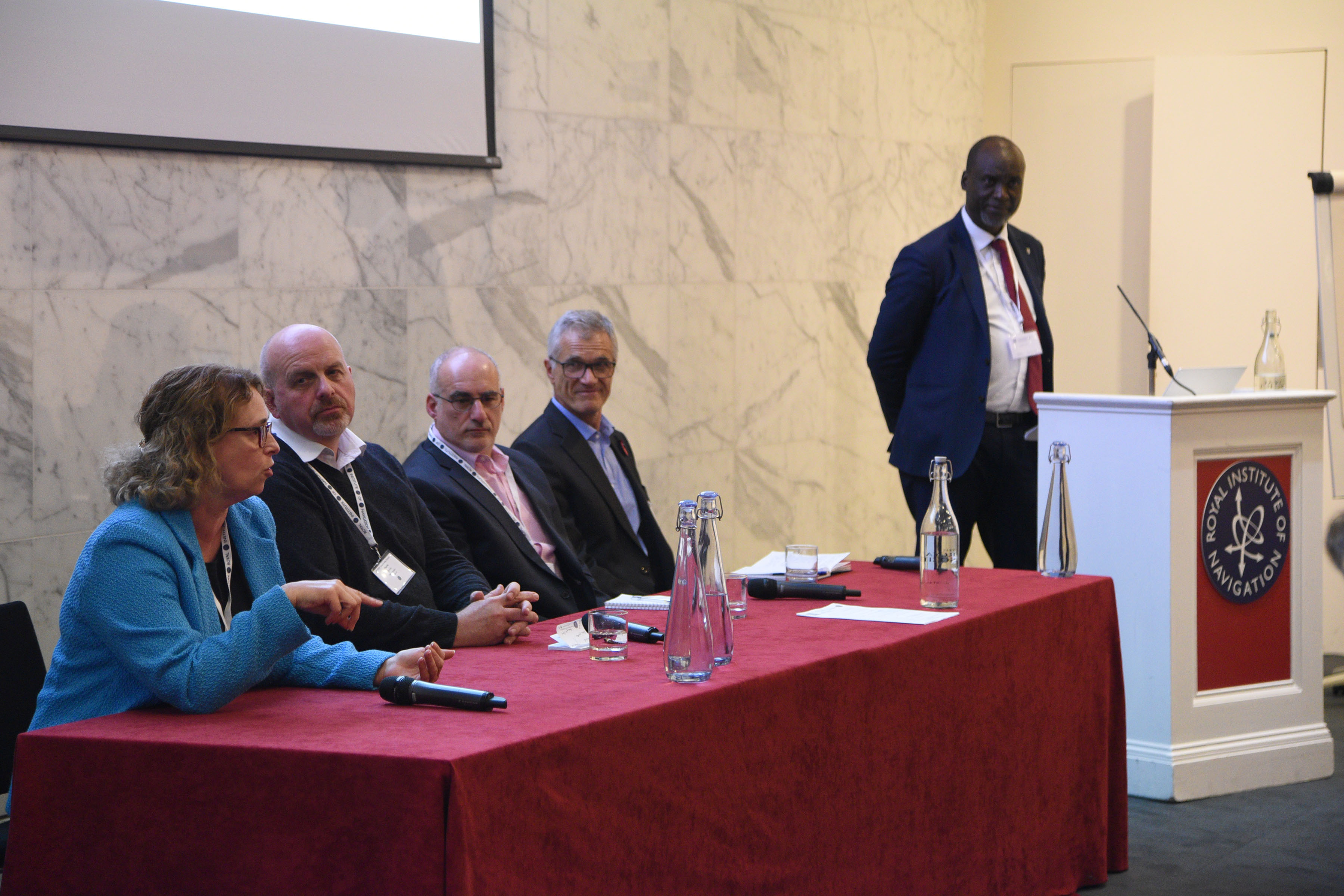
In our inaugural event on the 1st November we hosted around 100 senior Positioning, Navigation and Timing (PNT) leaders from across industry, academia and government at the Royal Society to discuss where PNT is in the UK, where the group thought it needed to be and how to get there. The meeting was held under Chatham House rules.

A primary keynote was given keynote on the economic benefits of resilient PNT to the UK. This reflected a hypothesis that ‘the UK can generate value and sustainable leadership from investing in resilient PNT, benefiting government, academia, industry and, ultimately, individuals.’ The London Economics concept paper that this is based on, which can be downloaded HERE, notes that the UK has significant economic value at risk to even a temporary outage of GNSS, with the road transport, emergency, and justice services, and maritime found to be most precariously positioned.
The London Economics paper continues to assess that major critical infrastructure sectors across the economy remain insufficiently prepared to face the consequences of outages or disruption to satellite-derived time and position, and that backup systems mitigate against the economic value risk.
A recommendation was made that additional work is needed to identify and rank mitigation strategies in order of priority based on strategic and economic factors, that these need to be funded to prove the concepts and that the sector itself should organise itself to present a coherent face to global partners and customers.
This echoed the introductory talks which discussed success being delivered through three functions; [having the right] infrastructure, [putting in place the right] leadership and governance, and [having a pipeline of] skills. The latter being identified through the day as a red flag for all concerned. Examples of open PNT roles were given by delegates, validating the point.
The main focus of the day was two excellent panel sessions, the first focussing on UK strengths, the second being concerned with examples of success but where there is room for improvement. The organisers were aiming for interactive discussion, and this was achieved, with many points being made by the wide range of delegates.
Some of the key messages and points made include:
• the ability to monetise PNT services is a challenge when competing against “free”1 with GPS.
• The role, if any, for better use of legislation, regulation, and standards in resilient PNT – this requires systems thinking and a market focus, moving away from silos that sometimes we fall into.
• The afternoon panel discussed the important point of careers and heard from all panellists about the need to create skills and career pathways from academia [including further education, not just universities] into industry and then structure for CPD.
• Overall, a strong call for co-ordinated action, led by government, on skills to have a greater focus that has been given thus far. It was recognised that individuals will invest their own careers in sectors with high growth and consistent investment. A strong strategy and programme for PNT in the UK would provide impetus and confidence for investment across the ecosystem, arguably reducing government’s own commitment required as well as reducing risks for all stakeholders.
• There was a clear wish for collaboration, particularly on governance and skills. There was a recognition that a range of short, medium and longer term actions will be needed. There was a strong call for RIN to be more proactive, and support for RIN taking leading roles in these areas.
Where the group saw the role of Government was an urgency to announce a strategy and associated governance and programmes. Such leadership and structure itself would build confidence and create/enable the conditions for industrial growth. There were several specific examples cited where the current lack of clear decisions is having real impacts on business decisions, with investment and skills going elsewhere, including overseas. Government leadership and targeted initial investments in R&D and skills, possibly infrastructure too, with a well-targeted legislative approach, would build confidence. This, in turn, would lead to increased investment across the sector, and from individuals wanting to invest their careers in PNT.

There was some discussion on how to support and encourage Government towards strategy and programme announcements. The MoD was cited as a good example where high priority has been given to [resilient] PNT. The attendees also were briefed on US experiences and that a more visible public information campaign and a visible and high-profile champion for PNT in the UK could be helpful.
Overall, the key messages from the meeting are below

What therefore is the role of the RIN in PNT going forward?
The RIN is a learned society and as such is very well-placed addressing long term thinking, strategies and providing input to setting goals with Government. There was a call for the RIN to be the voice of PNT and Resilient PNT in the UK which means not only “helping Government walk backwards over the bridge” but in building the bridge in the first place! The call for RIN to take a proactive and leading role in this way received wide and universal support.
The PNT Advisory Group (PNTAG), a special interest group under the Technical Committee, was warmly welcomed as the place to coalesce the UK’s PNT thoughts and directions but on the condition that it does something and not becomes a YATS (Yet Another Talking Shop). To that end I, in my summing up showed the PNTAG’s plan of action:

The immediate task for the PNTAG is to update this workplan2 to reflect the outcomes from the event and the community input.
Next will be to act on the plan and show that the RIN can deliver on leadership, long term thinking, support our colleagues in Government and to provide advice/guidance to the sector. We agreed we will plan to hold a repeat event around the same time next year where we will track progress – holding ourselves to account! The enthusiasm in the room on the day certainly gave me confidence that the plan is achievable.
To summarise and to channel one of the speakers’ comments a little, the takeaway for me is that for PNT in the UK, we have all the ingredients of success and growth, but need the recipe and hunger to cook the meal.
Our job is to pull the recipe for resilient PNT together and create the hunger for its implementation.
I would like to end with a call offers to contribute to the various work streams – please do get in touch with me if you are able to support this work.
Andy Proctor, MA CEng, FRIN, FIET
Chair, RIN PNT Advisory Group
[1] I know implementing GNSS services is not strictly free, but GPS is free to access, which is what I mean.
[2] If any readers would like information on any of the workstreams, I would be pleased to receive questions. (andy.proctor@rethinkpnt.com)
Tags:
PNT
position navigation and timing
resilient pnt
Permalink
| Comments (0)
|
|
|
Posted By Jade Morton,
07 December 2020
Updated: 02 November 2020
|
by Jade Morton, Frank van Diggelen, Bradford Parkinson
After more than five years of hard work by 131 authors from 18 countries, “Position, Navigation, and Timing Technologies in the 21st Century” (“PNT21”) is finally ready to meet the readers. Published by Wiley-IEEE Press, and written by world-renowned experts, PNT21 offers uniquely comprehensive coverage of the latest developments in the field of PNT .
PNT21 is a two-volume set containing 64 chapters organized into six parts. Volume 1 focuses on satellite navigation systems, technologies, and applications. It starts with a historical perspective of GPS and other related PNT development. Vol 1 Part A consists of 12 chapters on fundamentals and latest developments of global and regional satellite navigation systems (GNSS and RNSS), the need for their coexistence and mutual benefits, signal quality monitoring, satellite orbit and time synchronization, and satellite- and ground-based augmentation systems that provide information to improve the accuracy of navigation solutions. Part B contains 13 chapters on recent progress in satellite navigation receiver technologies such as vector processing, assisted and high sensitivity GNSS, precise point positioning (PPP) and real time kinematic (RTK) systems, direct position estimation techniques, and GNSS antennas and array signal processing. Also: the challenges of multipath-rich urban environments, in handling spoofing and interference, and in ensuring PNT integrity. Part C finishes the volume with 8 chapters on satellite navigation for engineering and scientific applications. A review of global geodesy and reference frames set the stage for discussions on the broad field of geodetic sciences, followed by a chapter on GNSS-based time and frequency distribution. Three chapters are dedicated to severe weather, ionospheric effects, and hazardous event monitoring. Finally, comprehensive treatments of GNSS radio occultation and reflectometry are provided.
Volume 2 addresses PNT using alternative signals and sensors and integrated PNT technologies for consumer and commercial applications. An overview chapter provides the motivation and organization of the volume, followed by a chapter on nonlinear estimation methods which are often employed in navigation system modeling and sensor integration. Vol 2 Part D devotes 7 chapters to PNT from various radio signals-of-opportunity transmitted from sources on the ground, from aircraft, or from low Earth orbit (LEO) satellites. In Part E, there are 8 chapters covering a broad range of non-radio frequency sensors operating in passive and active modes to produce navigation solutions, including MEMS inertial sensors, advances in clock technologies, magnetometers, imaging, LiDAR, digital photogrammetry, and signals received from celestial bodies. A tutorial-style chapter on GNSS/INS integration methods is included in this Part E. Also included in Part E are chapters on the neuroscience of navigation and animal navigation. Finally, Part F presents a collection of contemporary PNT applications such as surveying and mobile mapping, precision agriculture, wearable systems, automated driving, train control, commercial unmanned aircraft systems, aviation, satellite orbit determination and formation flying, and navigation in the unique Arctic environment.
Because of the diverse authorship and topics covered in PNT21, the chapters were written in a variety of styles. Some offer high-level reviews of progress in specific subject areas, while others are tutorials. A few chapters include links to MatLab or Python example code as well as test data for readers who desire hands-on practice. The collective goal is to appeal to industry professionals, researchers, and academics involved with the science, engineering, and application of PNT technologies. A website (pnt21book.com) provides downloadable code examples, data, homework problems, select high-resolution figures, errata, and a way for readers to provide feedback.
If you wish to purchase this book through www.wiley.com you can use a discount code for 30% off - please use code: VBS10 between 21st October and 31st December 2020.

Tags:
navigation
new book
PNT
position navigation and timing
technology
Permalink
| Comments (0)
|
|
|
Posted By Administration,
01 July 2020
|
On 10th June 2020, Dr Ramsey Faragher presented a webinar on a new method for processing GNSS radio signals called Supercorrelation. There were so many questions during the webinar that we couldn't get to everything in the time we had so Ramsey has kindly answered the remaining questions for us below. If you didn't catch the webinar at the time you can watch it back here and then read the Q&A below.
Does supercorrelation help with low signal situations? I mean help with getting a lock in low-signal situations (only reflections available) as opposed to getting a very precise position when line of sight signal is available.
There are two parts to answering this question:
1. Supercorrelation boosts sensitivity by around 7-20dB depending on the existing capabilities and performance of the receiver that the technology is going into. We are able to confidently track signals right down to 4dBHz with a 1-second-long Supercorrelation. The longest Supercorrelators we have tested with real data were 5 seconds long. The boost in sensitivity can often allow a weak and obstructed line of sight signal to be found, even if it was not apparently present according to a standard receiver.
2. Since the question specifically states “only reflections available” I will clarify that if all of the signals detected are reflected and no LOS are available then standard Supercorrelation will not see those reflected signals at all if they are coming into the antenna from a direction that does not correspond to the location of the satellite in the sky. However performing a Skyscan reveals where all the energy is coming from, and allows you to still make use of the measurements from those reflected paths if you have the means to do so. For example you could match them to buildings around you if you have a 3D building model, and then employ shadow matching or 3DMA. If low-accuracy positioning is acceptable for the use case (e.g. confirming location indoors to simply update a weather report on a smartphone) then weak non-line of sight signals can still be used, and the receiver would be able to warn that the positioning accuracy is being limited by the use of non-line-of-sight signals.
What are the input parameters to generate the skyscan energy maps?
Skyscans are created using a bank of Supercorrelators, each tuned to couple strongly to energy coming from different azimuths and elevations. So you are solving the same problems that are described in the talk for creating a Supercorrelator, but for a whole range of possible positions for the satellite across the sky.
When will we see this in nav Receivers on ships?
We are engaged with a number of GNSS hardware manufacturers and OEMs to bring the benefits of our technology to their customers as quickly as possible. Please ask your current GNSS receiver manufacturer to let you know their current level of progress in integrating our technology into their chipset.
When will we see in likes of iPhone?
FocalPoint are currently working with a number of major smartphone chipset providers and handset manufacturers. We are hoping to see smartphone deployments of S-GNSS within the next 2-3 years depending on the different chipset cycles between different manufacturers. Apple acquired the Intel GNSS chipset at the end of 2019 so they did very recently become a company that can directly deploy S-GNSS technology themselves directly.
Is there any limitation for the supercorrelation, especially in some very poor skywindow like the urban area in Hong kong
The key requirement for Supercorrelation to function is that the receiver’s antenna must be moving through space. The minimum speed requirement is a function of the desired length of the Supercorrelator, but for our usual settings, the minimum speed required is 5cm per second, which is roughly 20x slower than walking pace.
Thank you Dr. Ramsey for the presentation, very exciting. Question about latency : what is the net effect on latency compared to conventional GNSS of longer correlation period and improved accuracy of Supercorrelation?
The current latency is 0.5 seconds for our typical settings. However in our next generation of the Supercorrelator we expect to bring this down to a few milliseconds. Note also that the latency in the position estimate for existing smartphone receivers is typically about 1 second, because they typically average together about a second’s worth of GPS measurements before providing an output to the user in an attempt to reduce errors in the navigation solution. Such averaging is not required for Supercorrelation.
In a mobile phone the clock source will not be perfectly stable due to the thermal dynamics, how does this affect super correlation over 1sec
Yes we have seen great variations in the performance of smartphone oscillators. Not just from thermal dynamics but from other unpredictable factors. In some smartphones we have tested our technology on there can be regular discontinuous jumps of 100Hz or more. We had to develop specific clock modelling and signal processing techniques to account for these problems, including what we call the Ultracorrelator, which we did not have time to cover in the talk, but the patent is in the public domain if you would like to read how that works.
Hi Ramsey. Thanks for a very clear description. Do you have a rough estimate in MIPS (or similar) of the added processing needs. I am aware that we already use a huge amount in multipath mitigation, so I am looking for the difference between S-GPS and what we save from the conventional
Yes we have a variety of tools to answer this question for each chipset company, as they all have different existing capabilities before we add in our technology. In the best cases we can actually reduce the overall processing load because of the existing code and overhead that can be removed once Supercorrelation is added. For more thorough information about your chipset in particular please do get in touch.
Delighted that FPP have been given the DofE Award! My question is whether super correlation can be switched on/off by the user?
It is unlikely that this will be a user selectable option, but it is possible in principle.
Could the same method by applied to MMS GNSS receiver?
Supercorrelation can be applied to the ranging signals of all GNSSS, on all frequencies. It could also be applied to many terrestrial radio signals too.
How does the supercorrelation differ from autocorrelation?
Autocorrelation refers to when you correlate a signal with itself, in order to study particular properties of that signal. The supercorrelation process involves changing the correlator sequence stored locally to account for a set of error sources in order to provide a better estimate of the incoming radio signal from the satellite than you get by simply using the textbook description of what has been broadcast.
When do you expect this to become available in a product for the mass market?
FocalPoint are currently working with a number of major smartphone chipset providers and handset manufacturers. We are hoping to see smartphone deployments of S-GNSS within the next 2-3 years depending on the different chipset cycles between different manufacturers.
Tags:
gnss
gps
pnt
supercorrelation
technology
Permalink
| Comments (0)
|
|